

Favourite
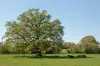
Roche-aux-Fées
| Municipality | Teillay |
|---|---|
| Postcode | 35620 |
| Latitude | 47.8068910 (N 47° 48’ 25”) |
| Longitude | -1.5388200 (W 1° 32’ 20”) |
| Altitude | From 37m to 98m |
| Surface area | 26.21 km² |
| Population | 1085 inhabitants |
| Density | 41 inhabitants/km² |
| Prefecture | Rennes (46 km, 43 min) |
| Insee code | 35332 |
| Intercommunality | CC Bretagne porte de Loire Communauté |
| Department | Ille-et-Vilaine |
| Region | Brittany |
| Ercé-en-Lamée | 3.3 km (6 min) |
|---|---|
| Soulvache | 6.1 km (11 min) |
| Ruffigné | 7.4 km (9 min) |
| Rougé | 8 km (8 min) |
| Thourie | 9.1 km (15 min) |
| Tresboeuf | 9.4 km (13 min) |
| Lalleu | 9.4 km (13 min) |
| La Bosse-de-Bretagne | 9.7 km (15 min) |
| Saint-Sulpice-des-Landes | 10.4 km (13 min) |
| Fercé | 11.9 km (15 min) |
| Saint-Aubin-des-Châteaux | 12.1 km (15 min) |
| Bain-de-Bretagne | 12.3 km (14 min) |
| Coësmes | 13.3 km (18 min) |
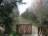
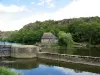
| Natural sites |
|---|
| Last name | Activity type | Rate | City |
|---|---|---|---|
 | Nature and the great outdoors | 6 € to 9 € | Carentoir (42 km) |
| Last name | Outing type | Difficulty | Duration | Departure municipality |
|---|---|---|---|---|
 | Cycling itinerary | Easy | 1:15 | Rougé (7.1 km) |
 | Hike | Intermediate | 3:00 | Piré-Chancé (24 km) |
 | Snowshoe hike | Intermediate | 2:30 | Pont-Péan (26 km) |
 | Hike | Intermediate | 2:50 | Bruz (26 km) |
 | All-terrain bike itinerary | Athletic | 2:15 | Vern-sur-Seiche (27 km) |