
Favourite
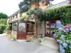
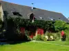
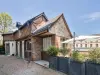
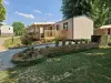
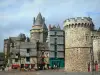
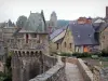
Vitré
| Municipality | Taillis |
|---|---|
| Postcode | 35500 |
| Tourism label | ") |
| Latitude | 48.1890390 (N 48° 11’ 21”) |
| Longitude | -1.2389060 (W 1° 14’ 20”) |
| Altitude | From 72m to 136m |
| Surface area | 12.27 km² |
| Population | 1030 inhabitants |
| Density | 83 inhabitants/km² |
| Prefecture | Rennes (51 km, 48 min) |
| Insee code | 35330 |
| Intercommunality | CA Vitré Communauté |
| Department | Ille-et-Vilaine |
| Region | Brittany |
| Saint-Christophe-des-Bois | 4.6 km (7 min) |
|---|---|
| Balazé | 4.6 km (9 min) |
| Châtillon-en-Vendelais | 6.8 km (11 min) |
| Montreuil-sous-Pérouse | 6.9 km (9 min) |
| Vitré | 8.3 km (13 min) |
| Val-d'Izé | 8.4 km (10 min) |
| Montreuil-des-Landes | 8.5 km (13 min) |
| Mecé | 9.5 km (12 min) |
| Combourtillé | 9.8 km (10 min) |
| Saint-M'Hervé | 10.6 km (18 min) |
| Montautour | 10.8 km (18 min) |
| Landavran | 11.1 km (13 min) |
| Billé | 11.4 km (12 min) |
| Champeaux | 11.5 km (15 min) |
| Natural sites |
|---|
| Last name | Outing type | Difficulty | Duration | Departure municipality |
|---|---|---|---|---|
 | Hike | Intermediate | 2:10 | La Bouëxière (14.7 km) |
 | Hike | Intermediate | 2:00 | Ercé-près-Liffré (22 km) |
 | Hike | Easy | 2:00 | Liffré (24 km) |
 | Hike | Intermediate | 2:45 | Châteaugiron (25 km) |
 | Hike | Intermediate | 3:00 | Piré-Chancé (25 km) |