


Favourite
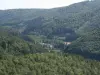
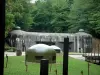
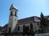
The Schoenenbourg Fort
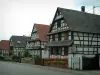
| Municipality | Surbourg |
|---|---|
| Postcode | 67250 |
| Latitude | 48.9089540 (N 48° 54’ 32”) |
| Longitude | 7.8501280 (E 7° 51’ 0”) |
| Altitude | From 144m to 218m |
| Surface area | 10.46 km² |
| Population | 1741 inhabitants |
| Density | 166 inhabitants/km² |
| Prefecture | Strasbourg (45 km, 34 min) |
| Insee code | 67487 |
| Intercommunality | CC de l'Outre-Forêt |
| Department | Bas-Rhin |
| Territory | Alsace |
| Region | Great East |
| Kuhlendorf | 4.1 km (6 min) |
|---|---|
| Betschdorf | 4.1 km (6 min) |
| Soultz-sous-Forêts | 4.3 km (6 min) |
| Merkwiller-Pechelbronn | 4.5 km (6 min) |
| Retschwiller | 6.3 km (9 min) |
| Biblisheim | 6.6 km (10 min) |
| Gunstett | 6.6 km (8 min) |
| Kutzenhausen | 6.8 km (10 min) |
| Preuschdorf | 7 km (12 min) |
| Lampertsloch | 7.1 km (12 min) |
| Walbourg | 7.6 km (8 min) |
| Schoenenbourg | 7.6 km (11 min) |
| Hoffen | 8.1 km (8 min) |
| Memmelshoffen | 8.2 km (12 min) |
| Transport |
|---|
| Last name | Activity type | Rate | City |
|---|---|---|---|
 | Culture and education | 4 € to 6 € | Kutzenhausen (2.8 km) |
 | Sports sensations | 25 € to 80 € | Niederbronn-les-Bains (15.5 km) |
 | Arts and Crafts | 50 € | Hoerdt (24 km) |
 | Entertainment | 24 € | Strasbourg (37 km) |
| Last name | Outing type | Difficulty | Duration | Departure municipality |
|---|---|---|---|---|
 | Hike | Easy | 2:00 | Hatten (9.8 km) |
| Mountain bike itinerary | Easy | 20 min | Soufflenheim (11.9 km) |
 | Hike | Athletic | 2:50 | Wingen-sur-Moder (34 km) |
 | Hike | Easy | 1:30 | Schiltigheim (34 km) |
 | Hike | Athletic | 4:20 | Zittersheim (37 km) |