
Favourite
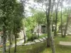
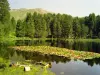
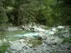
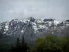
Mountain lakes
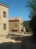
| Municipality | Soccia |
|---|---|
| Postcode | 20125 |
| Latitude | 42.1889570 (N 42° 11’ 20”) |
| Longitude | 8.9101090 (E 8° 54’ 36”) |
| Altitude | From 409m to 2100m |
| Surface area | 28.27 km² |
| Population | 154 inhabitants |
| Density | 5 inhabitants/km² |
| Prefecture | Ajaccio (68 km, 1:09) |
| Insee code | 2A282 |
| Intercommunality | CC Spelunca-Liamone |
| Department | Southern Corsica |
| Region | Corsica |
| Poggiolo | 2.2 km (3 min) |
|---|---|
| Orto | 4.8 km (9 min) |
| Guagno | 10.9 km (19 min) |
| Murzo | 12.2 km (20 min) |
| Vico | 16.6 km (27 min) |
| Balogna | 21 km (37 min) |
| Arbori | 24 km (40 min) |
| Renno | 25 km (41 min) |
| Letia | 26 km (41 min) |
| Rosazia | 26 km (43 min) |
| Coggia | 30 km (53 min) |
| Salice | 31 km (51 min) |
| Cristinacce | 32 km (49 min) |
| Natural sites |
|---|
| Last name | Activity type | Rate | City |
|---|---|---|---|
 | Sports sensations | 25 € | Vivario (18.9 km) |
 | Nature and the great outdoors | 35 € to 75 € | Porto (19.8 km) |
 | Entertainment | 45 € | Ota (19.9 km) |
 | Entertainment | 30 € | Ota (19.9 km) |
 | Nature and the great outdoors | 0 € to 78 € | Cargèse (27 km) |
| Last name | Outing type | Difficulty | Duration | Departure municipality |
|---|---|---|---|---|
 | Village visit | Easy | 1:00 | Albitreccia (33 km) |
 | Hike | Intermediate | 1:50 | Pietrosella (40 km) |
 | Hike | Intermediate | 2:35 | Pietrosella (41 km) |
 | Hike | Intermediate | 1:30 | Pietrosella (43 km) |
 | Hike | Easy | 1:30 | Sainte-Lucie-de-Tallano (56 km) |