Favourite
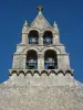
The Nouaillé-Maupertuis abbey
| Municipality | Smarves |
|---|---|
| Postcode | 86240 |
| Latitude | 46.5109009 (N 46° 30’ 39”) |
| Longitude | 0.3502520 (E 0° 21’ 1”) |
| Altitude | From 72m to 141m |
| Surface area | 20.09 km² |
| Population | 2957 inhabitants |
| Density | 147 inhabitants/km² |
| Prefecture | Poitiers (12.4 km, 18 min) |
| Insee code | 86263 |
| Intercommunality | CC des Vallées du Clain |
| Department | Vienne |
| Territory | Poitou |
| Region | New-Aquitaine |
| Ligugé | 2.3 km (8 min) |
|---|---|
| Roches-Prémarie-Andillé | 4.1 km (5 min) |
| Iteuil | 4.7 km (8 min) |
| Saint-Benoît | 5.4 km (8 min) |
| La Villedieu-du-Clain | 6.8 km (8 min) |
| Croutelle | 7.4 km (11 min) |
| Mignaloux-Beauvoir | 8.1 km (12 min) |
| Nouaillé-Maupertuis | 8.4 km (11 min) |
| Poitiers | 9.7 km (16 min) |
| Fontaine-le-Comte | 9.8 km (15 min) |
| Aslonnes | 10.1 km (11 min) |
| Biard | 11.7 km (16 min) |
| Vouneuil-sous-Biard | 12.2 km (18 min) |
| Nieuil-l'Espoir | 12.5 km (17 min) |
| Last name | Outing type | Difficulty | Duration | Departure municipality |
|---|---|---|---|---|
 | All-terrain bike itinerary | Easy | 2:30 | Lussac-les-Châteaux (31 km) |
 | All-terrain bike itinerary | Easy | 3:20 | Lussac-les-Châteaux (31 km) |
 | Hike | Easy | 40 min | Lussac-les-Châteaux (31 km) |
 | Hike | Easy | 3:20 | Saint-Martin-l'Ars (36 km) |
 | Hike | Easy | 1:10 | Antigny (39 km) |