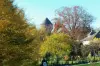
Located on the foothills of the Massif Central, the town has a hilly terrain characterized by wooded hills and mini-plates with average heights ranging from 420 to 547 meters of Puy Ferrieres. From this plateau, you can enjoy a splendid panorama over the whole mass Monedieres.
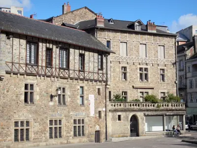
The name "Seilhac" comes from the combination of the name of a man, "Salins", owner of a farm, the Latin suffix "acum". The formation of the name of the town is earlier than the sixth century. Seilhac is known since the 7th century, the remains of the Gallo-Roman period reflect this origin.
Its position at the crossroads of old roads gave the town its growth. In 1784, Turgot, then intendant of the Limousin, establishes the route between Paris in the center of France. Through the influence of the Marquis of Seilhac, this road passed through the town of the same name. In 1790, the town was elevated to the political center in the organization of departments and gives its name to the district which he is the chief town.
")