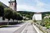
Saint-Nabord is a town in the Vosges department, in the Grand Est region, north-west of Remiremont, with which it borders.
Its territory is vast of 38 km ², along for 14 km the left bank of the course of the Moselle, ranging from 367 to 632 m of altitude.
It includes some 2000 hectares of wooded areas and several bodies of water.
The green landscape is also reflected thanks to the pastures dedicated to cattle breeding (milk and meat production). To this economic sector, in recent decades have been added wholesale businesses and agro-food businesses.
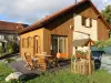
Composed of a town and several hamlets, the town formed during the Revolution by bringing together several rural communities was urbanized in the 20th century thanks to the proximity of Remiremont and now has 4000 inhabitants.
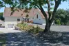
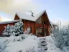
It has preserved its historical and natural heritage, presenting first-rate assets for lovers of green tourism thanks to its forests, ponds and banks of the Moselle.
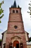
To discover the heritage of the locality, a route can begin with the parish church dedicated to Saints Nabord and Gorgon and which houses an 18th century bell. The so-called Lambert Way Cross and above all the Sainte-Anne chapel, the existence of which has been attested from the 16th century onwards, are also protected as historical monuments. It then serves an important smallholding belonging to the chapter of Remiremont. In the 17th century, the building became the property of Princess Catherine of Lorraine, then in 1791 the chapel was sold as national property. Acquired by the town in 2010, the chapel has been restored and its square steeple, specific to its otherwise quite sober architecture, contains a bell dated 1902. For a visit, contact +33 3 29 62 46 55 or +33 3 29 62 24 22.
Still during a walk dedicated to the history of Saint-Nabord, we will notice the Noirgueux stele which pays homage to the American soldiers who crossed the Moselle in September 1944 to liberate the agglomeration of Remiremont. Commemorative ceremonies with re-enactments take place every year at this location, the site being included in an educational trail dedicated to this sensitive natural area to the north-east of the village.
Finally, we can linger in front of the birthplace of General Jean Humbert (1767-1823), who fought the Vendeans, took part in the Irish War of Independence then, at the beginning of the 19th century, won the 'America. The property is private.
It is then advisable to stop by the House of History and Heritage. There are collections of furniture, clothes and other tools, objects and documents on display that allow you to understand everyday life in the Vosges in the 19th century. An interior has been reconstructed (kitchen, bedrooms, living rooms, etc.). Handicrafts are also mentioned, and a room is dedicated to General Humbert. Open in July and August, by appointment the rest of the year. Free admission. Contact +33 3 29 62 46 55.
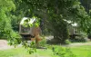
Via marked trails, the discovery of the town's rich natural heritage will delight hikers and visitors in search of green landscapes.
Several sites are particularly interesting geologically or ecologically. This is the case with the Noirgueux moraine, over 90 hectares, a set of gravel, pebbles and sands which bear witness to the presence of an ancient glacier 15,000 years ago.
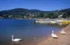
The ponds of the Vouau meadow, fed by the Moselle, the Huchère pond, covered with water lilies, in the heart of the forest, or the Demoiselle pond, of glacial origin, managed by the Conservatory of Natural Areas of Lorraine, renowned for its richness in terms of flora and fauna, are also to be seen. As for the Montiroche belvedere, it offers an exceptional panorama over the valley and the town of Remiremont.
In total, 50 km of signposted hikes allow you to discover all this environmental wealth, without forgetting of course the 2000 hectares of forests (pines, oaks, beeches, etc.). Maps and information on +33 3 29 62 23 70.
Most ponds and the banks of the Moselle are accessible to fishermen: find out about suitable sites and the regulations on +33 3 29 23 04 98.
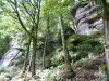
Are finally established two climbing sites (information on +33 6 88 08 54 65), an orienteering course and trails that can be used for cross-country skiing during snowy winters or even mountain biking circuits (information on +33 3 29 62 23 70).
As for the Moselle, if you can walk with pleasure on its banks, it is also possible in season to cross it by canoe: contact the local club on +33 3 29 34 10 33.