

Favourite
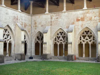
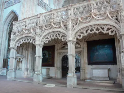
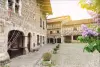
Ambronay Abbey
| Municipality | Saint-Martin-du-Mont |
|---|---|
| Postcode | 01160 |
| Latitude | 46.1015760 (N 46° 6’ 6”) |
| Longitude | 5.3277000 (E 5° 19’ 40”) |
| Altitude | From 246m to 556m |
| Surface area | 28.09 km² |
| Population | 1922 inhabitants |
| Density | 68 inhabitants/km² |
| Prefecture | Bourg-en-Bresse (17 km, 25 min) |
| Insee code | 01374 |
| Intercommunality | CA du Bassin de Bourg-en-Bresse |
| Department | Ain |
| Territories | Alps, Jura mountains |
| Region | Auvergne-Rhône-Alps |
| Tossiat | 4.9 km (7 min) |
|---|---|
| Neuville-sur-Ain | 5.1 km (15 min) |
| Journans | 6.4 km (12 min) |
| Druillat | 6.8 km (12 min) |
| La Tranclière | 7.7 km (14 min) |
| Pont-d'Ain | 8.1 km (11 min) |
| Certines | 8.2 km (12 min) |
| Bohas-Meyriat-Rignat | 8.4 km (14 min) |
| Bohas | 8.4 km (15 min) |
| Revonnas | 8.5 km (13 min) |
| Poncin | 8.7 km (19 min) |
| Varambon | 9.8 km (13 min) |
| Ceyzériat | 10.2 km (17 min) |
| Montagnat | 12.1 km (17 min) |
| Last name | Activity type | Rate | City |
|---|---|---|---|
 | Entertainment | 17 € | Pérouges (25 km) |
 | Culture and education | 36 € | Pérouges (25 km) |
 | Sports sensations | 37 € | Joudes (40 km) |
| Last name | Outing type | Difficulty | Duration | Departure municipality |
|---|---|---|---|---|
 | Hike | Easy | 55 min | Serrières-sur-Ain (10.7 km) |
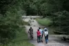 | Hike | Easy | 1:10 | Péronnas (10.9 km) |
 | Hike | Intermediate | 4:45 | Bolozon (15.1 km) |
 | Hike | Intermediate | 7:20 | Saint-Denis-en-Bugey (16.7 km) |
 | Hike | Easy | 2:35 | Nurieux-Volognat (17.4 km) |


