Liven up your holidays!

Saint-Ferréol

Tourism, holidays & weekends guide in the Haute-Savoie

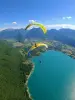
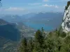
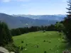
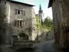
The territory of the commune of Saint-Ferréol is located in the south-east of France, in the south-eastern part of the department of Haute-Savoie, on the slopes of the mountain of Arclosan and Nantbellet, in the north-eastern quarter. west of the French Alps.

It is located 2 kilometers north of Faverges-Seythenex, on the road that leads to Thônes. It is built at the top of the dejection cone of the Chair, at the outlet of narrow and wooded gorges, which lead upstream to Serraval. The town culminates at 2,038 meters, at the tip of Beccaz, bordering with Montmin.

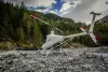
The River de la Chaise, which has its source near Serraval, flows into the Arly.

In Saint-Ferréol, the Chair is also called Biel.

Geographical information

MunicipalitySaint-Ferréol
Postcode74210
Latitude45.7659720 (N 45° 45’ 57”)
Longitude6.3055430 (E 6° 18’ 20”)
AltitudeFrom 479m to 2038m
Surface area16.79 km²
Population920 inhabitants
Density54 inhabitants/km²
PrefectureAnnecy (26 km, 33 min)
Insee code74234
IntercommunalityCC des Sources du Lac d'Annecy
DepartmentHaute-Savoie
TerritoryAlps
RegionAuvergne-Rhône-Alps

Nearest cities & towns

Faverges-Seythenex3.1 km (6 min)
Val de Chaise4 km (9 min)
Giez6.9 km (11 min)
Serraval7.4 km (10 min)
Doussard9.9 km (13 min)
Chevaline10.1 km (15 min)
Le Bouchet-Mont-Charvin10.8 km (15 min)
Ugine11.3 km (15 min)
Lathuile11.7 km (15 min)
Les Clefs14.3 km (20 min)
Duingt14.9 km (19 min)
Talloires-Montmin15.6 km (20 min)
Marthod15.9 km (21 min)
Thônes16.9 km (23 min)

Things to see and do

The neoclassical houses a series of murals depicting the highlights of the Christian life of the inhabitants. The tour continues with the discovery of the operation of the mill that uses the power of water to activate the swing, and by passing in front of beautiful old houses dating from the 16th to the 18th century. It ends with a meeting with a breeder and producer of goat cheeses.

Weather

Thursday 25 april
Min. -2°C - Max. 7°C
Day
Night
Friday 26 april
Min. 3°C - Max. 8°C
Day
Night
Saturday 27 april
Min. 5°C - Max. 13°C
Day
Night

Visits, leisure and activities nearby

Leisure activities

Last nameActivity typeRateCity
Maiden paraglider flight in Annecy
Sports sensations85 € to 190 € Doussard (6.5 km)
Paragliding above Lake Annecy
Sports sensations85 € to 150 € Doussard (6.7 km)
Paragliding above Lake Annecy
Sports sensations90 € to 250 € Doussard (7.1 km)
Thrilling canyoning descent to Lake Annecy - Beginner/intermediate level
Sports sensations55 € Talloires-Montmin (8.9 km)
Helicopter flight over Annecy and Beaufortain
Sports sensations600 € Les Saisies (17.9 km)

Outings

Last nameOuting typeDifficultyDurationDeparture municipality
Taillefer Duingt loop
HikeIntermediate3:30Lathuile (8.2 km)
Mountain Coal
HikeIntermediate6:00Lathuile (8.7 km)
The Arc Pass
HikeIntermediate5:00Pussy (25 km)
Arc Pass
HikeAthletic5:30La Léchère (26 km)
The Big House
HikeIntermediate5:00La Léchère (26 km)

Restaurants

Bed & breakfasts

Vacation rentals

Campsites

Hotels

Your holidays
A hotel
A vacation rental
A bed & breakfast
A campsite
A leisure activity
A restaurant
A rental car
A plane ticket
By continuing to browse our site, you are agreeing to the use of cookies to improve your experience and make targeted offers.
Find out more and make settings
Your account