Liven up your holidays!

Saint-Dalmas-le-Selvage

Tourism, holidays & weekends guide in the Alpes-Maritimes

Saint-Dalmas-le-Selvage - Tourism, holidays & weekends guide in the Alpes-Maritimes
9.1
10

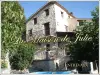
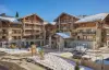
Nestled at the confluence of the valleys of Gialorgues and Sestriere, this authentic village charm lies 1500 m above sea level and is to be the higher of the Alpes-Maritimes.

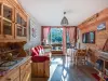
Strolling through the cobbled streets you will be surprised by the architecture and sundials once the heartbeat of the daily lives of residents.

This village still has an agricultural activity and hosts its rich pastures and herders with their sheep in summer.

There is also an exceptional religious heritage with its church and bell tower of the eighteenth. The church is listed in the inventory of historical monuments.

A third of the territory of the municipality is included in the Mercantour National Park. "Selvage" comes from the Latin "sylvatica" which means forest.

The richness of its forests in the landscape but also an abundant and varied wildlife make it a welcome site for lovers of the altitude and the Mountain. A world to share and to share in any season: vibrant colors and stillness of autumn, winter in white and blue animated spring and awakening of nature or sunny summer full of freshness.

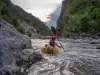
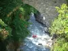
As part of a discovery or a pleasure, the practice of snowshoeing, cross country skiing, ski hiking or rock climbing frozen waterfalls will delight everyone.

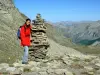
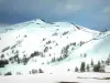
Saint-Dalmas-le-Selvage is a site of Nordic skiing and hiking with more than 50 km of marked trails ranging from 1280 m to 2881 m.

There are two areas of Nordic walking, and Anelle Gianto, from the parking of the village with 35 km of routes.

To practice skiing you have 17 km of trails.

It is also possible to go climbing frozen waterfalls, since there are two cascades of 100 and 150 m, with free access. They are reserved for insiders equipped with appropriate equipment.

Geographical information

MunicipalitySaint-Dalmas-le-Selvage
Postcode06660
Latitude44.2842310 (N 44° 17’ 3”)
Longitude6.8659220 (E 6° 51’ 57”)
AltitudeFrom 1280m to 2881m
Surface area81.03 km²
Population107 inhabitants
Density1 inhabitants/km²
PrefectureNice (97 km, 1:39)
Insee code06119
IntercommunalityME Métropole Nice Côte d'Azur
DepartmentAlpes-Maritimes
TerritoriesAlps, French Riviera
RegionProvence-Alps-French Riviera

Nearest cities & towns

Saint-Étienne-de-Tinée7.6 km (14 min)
Auron15.1 km (24 min)
Isola23 km (31 min)
Uvernet-Fours36 km (1:17)
Barcelonnette41 km (1:23)
Saint-Pons42 km (1:25)
Pra-Loup43 km (1:27)
Faucon-de-Barcelonnette43 km (1:26)
Entraunes44 km (1:29)
Le Sauze45 km (1:28)
Enchastrayes47 km (1:30)
Roubion48 km (59 min)
Jausiers49 km (1:31)
La Condamine-Châtelard54 km (1:36)

Things to see and do

The parish church of Saint-Dalmas, listed in the supplementary inventory of historic buildings, was originally a priory of the Benedictine abbey of Pedona (Piedmont). The bell tower erected in 1718 by the Count of Saint-Dalmas, is one of nine towers Lombard Valley Tinée. A magnificent equestrian painting of Saint-Dalmas adorns the main facade above the porch awning. Inside the church has two primitive Nice: "The triptych of St Pancras" (1515) and "The triptych of the Virgin" (1521). The church contains two more paintings: "The Lamentation of Christ" (1652), painted by Pierre Pons and "Intercession of St. Gregory for the Souls in Purgatory" (1696) by Jacques Bottero.

In the village center, the Sainte-Marguerite, Monument History, presents a Crucifixion of 1662 and a statue of St Margaret's issuant dragon carved polychrome wood, and finally we discovered the murals in 1996 attributed to John Baleison dating from the late 15th century.

Strolling through the cobbled streets you will find houses typical mountain architecture, with three very steep covered with larch shingles and sundials adorning many walls, some dating from the 18th century.

Places of interest

Monuments
Natural sites

Events and festivities

The Stride winter in February. Two courses, two difficulties for an event that brings together athletes and families.

Photos

Church of Saint-Dalmas-le-Selvage
See photo
Saint-Dalmas-le-Selvage
See photo
The village of Saint-Dalmas-le-Selvage
See photo
The village
The village
See photo
Icefall
Icefall
See photo
Snowshoeing
Snowshoeing
See photo
Saint-Dalmas-le-Selvage
See photo
Vallon of Gialorgues
See photo
Icefall
Icefall
See photo

Weather

Thursday 25 april
Min. -3°C - Max. 8°C
Day
Night
Friday 26 april
Min. -2°C - Max. 3°C
Day
Night
Saturday 27 april
Min. 0°C - Max. 4°C
Day
Night

Visits, leisure and activities nearby

The Col de la Bonnette: at 2802 meters above sea level: The highest road in Europe, linking Nice to Briançon. At the top of Bonette, the view is magnificent, the view of the Northern Alps and Mount Viso in Italy is beautiful... At your binoculars!

The Mercantour National Park: This area is home to a space of harmony between protection, discovery, local development and respect for traditional activities. Everywhere, nature deserves attention and respect: better than picking admire, quietly observed that disturb...

Leisure activities

Last nameActivity typeRateCity
Equestrian activity in the Ubaye Valley
Sports sensations65 € Jausiers (17.3 km)
Two-day survival course in Ubaye
Nature and the great outdoors180 € Faucon-de-Barcelonnette (19.3 km)
Aqua-hike in Haute Ubaye
Sports sensations55 € to 90 € Saint-Paul-sur-Ubaye (27 km)
Rafting or hydrospeed down the Ubaye
Sports sensations45 € to 85 € Le Lauzet-Ubaye (39 km)
Sportive Canoe Rafting on your own on the Var River – 1 hour from Nice
Sports sensations30 € Villars-sur-Var (42 km)

Outings

Last nameOuting typeDifficultyDurationDeparture municipality
Rabuons Lake
Village visitAthletic7:00Saint-Étienne-de-Tinée (5.7 km)
Lakes Vens
HikeIntermediate6:30Saint-Étienne-de-Tinée (5.7 km)
Tour of the lakes
HikeIntermediate3:30Entraunes (10.1 km)
Plateau of St. Barnaby
HikeEasy1:00Saint-Martin-d'Entraunes (17.8 km)
Black Wood Tour
HikeIntermediate3:00Valdeblore (36 km)

Restaurants

Bed & breakfasts

Vacation rentals

Campsites

Hotels

Your holidays
A hotel
A vacation rental
A bed & breakfast
A campsite
A leisure activity
A restaurant
A rental car
A plane ticket
By continuing to browse our site, you are agreeing to the use of cookies to improve your experience and make targeted offers.
Find out more and make settings
Your account