Liven up your holidays!

Saint-Coutant

Tourism, holidays & weekends guide in the Deux-Sèvres

Saint-Coutant - Tourism, holidays & weekends guide in the Deux-Sèvres
8.9
2

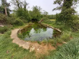
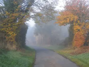
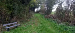
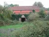
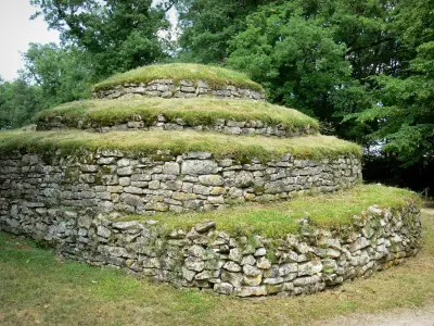
Saint-Coutant (sanctus constantius) which has many attractions, is a town of about thirty hamlets, ideally located on the edge of the Mellois plateau, on the route of a Gallo-Roman road, and directly above the meridian of Greenwich. you can discover the church of Saint-Gilles, the castle of Germain, the source of the Dive du Sud and its hiking trails.

A scientific hiking trail is dotted with 9 information panels on the town's natural resources: geology (water resources and memory of the earth), botany (hedgerow, fresh and silica forests), history and archeology (plot and feudal mound), astronomy (sundial time) and Roman road.

Its location on the edge of the Mellois plateau offers a hilly and diversified landscape.

Geographical information

MunicipalitySaint-Coutant
Postcode79120
Latitude46.2289079 (N 46° 13’ 44”)
Longitude-0.0117400 (W 0° 0’ 42”)
AltitudeFrom 124m to 164m
Surface area11.94 km²
Population282 inhabitants
Density23 inhabitants/km²
PrefectureNiort (41 km, 47 min)
Insee code79243
IntercommunalityCC Mellois en Poitou
DepartmentDeux-Sèvres
TerritoryPoitou
RegionNew-Aquitaine

Nearest cities & towns

Saint-Vincent-la-Châtre2.7 km (6 min)
Sainte-Soline4.7 km (12 min)
Lezay6.1 km (10 min)
Clussais-la-Pommeraie7.2 km (11 min)
Maisonnay7.9 km (12 min)
Vanzay10.7 km (17 min)
Alloinay10.8 km (19 min)
Melle11.5 km (20 min)
Fontivillié12 km (18 min)
Chey12.4 km (15 min)
Pers12.8 km (17 min)
Vançais12.9 km (19 min)
Chenay13.7 km (18 min)
Mairé-Levescault13.8 km (18 min)

Things to see and do

Events and festivities

Garage sale of May 1st.

Portes Ouvertes EARL Les Gilères

Photos

Château de Germain
Château de Germain
See photo
Source of the Dive du Sud
See photo
Roman road
Roman road
See photo
Saint-Gilles church
Saint-Gilles church
See photo
The harvest
The harvest
See photo
Trail
Trail
See photo
Start of the hiking trail - Washhouse
See photo
Trail
Trail
See photo
Church choir
Church choir
See photo
1 of the 9 trail signs
See photo

Weather

Wednesday 24 april
Min. 4°C - Max. 13°C
Day
Night
Thursday 25 april
Min. 6°C - Max. 15°C
Day
Night
Friday 26 april
Min. 5°C - Max. 12°C
Day
Night

Visits, leisure and activities nearby

Outings

Last nameOuting typeDifficultyDurationDeparture municipality
Botanical trail
HikeEasy1:00Mons (40 km)
Saint Martin L'Ars: between architectural heritage and nature
HikeEasy3:20Saint-Martin-l'Ars (42 km)
Taste the charms of the Availles Limouzine countryside
Car itineraryEasy55 minAvailles-Limouzine (53 km)
Between trails and alleys in Availles Limouzine
HikeIntermediate55 minAvailles-Limouzine (53 km)
South of Isle Jourdain, in the heart of the Vienne Valley
Car itineraryEasy1:05L'Isle-Jourdain (54 km)

Restaurants

Bed & breakfasts

Vacation rentals

Hotels

Your holidays
A hotel
A vacation rental
A bed & breakfast
A campsite
A leisure activity
A restaurant
A rental car
A plane ticket
By continuing to browse our site, you are agreeing to the use of cookies to improve your experience and make targeted offers.
Find out more and make settings
Your account