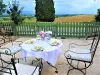


Favourite
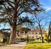
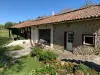
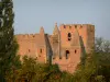
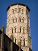
The fortified church of Simorre
| Municipality | Saint-Caprais |
|---|---|
| Postcode | 32200 |
| Latitude | 43.5937399 (N 43° 35’ 37”) |
| Longitude | 0.7861750 (E 0° 47’ 10”) |
| Altitude | From 155m to 237m |
| Surface area | 7.89 km² |
| Population | 147 inhabitants |
| Density | 18 inhabitants/km² |
| Prefecture | Auch (22 km, 26 min) |
| Insee code | 32467 |
| Intercommunality | CC des Coteaux Arrats Gimone |
| Department | Gers |
| Territories | Gascony, Midi-Pyrénées |
| Region | Occitanie |
| Bédéchan | 3.1 km (6 min) |
|---|---|
| L'Isle-Arné | 3.8 km (6 min) |
| Aurimont | 4.1 km (7 min) |
| Tirent-Pontéjac | 6.2 km (8 min) |
| Lussan | 6.8 km (10 min) |
| Saint-André | 7.2 km (12 min) |
| Juilles | 7.6 km (9 min) |
| Montiron | 7.6 km (14 min) |
| Castelnau-Barbarens | 7.9 km (11 min) |
| Aubiet | 8.3 km (13 min) |
| Boulaur | 9 km (11 min) |
| Bézéril | 10.1 km (15 min) |
| Saramon | 11 km (12 min) |
| Lahas | 11.1 km (18 min) |
| Last name | Outing type | Difficulty | Duration | Departure municipality |
|---|---|---|---|---|
 | Hike | Intermediate | 3:25 | Castelnau-Barbarens (5.3 km) |
 | Hike | Easy | 35 min | Lombez (16.6 km) |
 | Hike | Easy | 2:30 | Bazian (38 km) |
 | Village visit | Intermediate | 2:00 | Carbonne (49 km) |
 | All-terrain bike itinerary | Easy | 50 min | Castelsarrasin (56 km) |