


Favourite
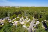
Orsan Priory Gardens
| Municipality | Saint-Baudel |
|---|---|
| Postcode | 18160 |
| Latitude | 46.8382810 (N 46° 50’ 18”) |
| Longitude | 2.2071880 (E 2° 12’ 26”) |
| Altitude | From 137m to 181m |
| Surface area | 30.09 km² |
| Population | 254 inhabitants |
| Density | 8 inhabitants/km² |
| Prefecture | Bourges (38 km, 42 min) |
| Insee code | 18199 |
| Intercommunality | CC Arnon Boischaut Cher |
| Department | Cher |
| Territory | Berry |
| Region | Centre-Loire Valley |
| Villecelin | 2.1 km (4 min) |
|---|---|
| Montlouis | 4.2 km (6 min) |
| Mareuil-sur-Arnon | 6.3 km (9 min) |
| La Celle-Condé | 7.1 km (11 min) |
| Chezal-Benoît | 8.9 km (13 min) |
| Châteauneuf-sur-Cher | 8.9 km (10 min) |
| Venesmes | 9.1 km (12 min) |
| Lignières | 11.6 km (17 min) |
| Corquoy | 12.6 km (14 min) |
| Ségry | 13.5 km (15 min) |
| Chavannes | 13.6 km (15 min) |
| Saint-Symphorien | 13.8 km (17 min) |
| Saint-Ambroix | 14.1 km (16 min) |
| Saint-Hilaire-en-Lignières | 14.4 km (22 min) |
| Natural sites |
|---|
| Last name | Activity type | Rate | City |
|---|---|---|---|
 | Entertainment | 75 € to 120 € | Issoudun (21 km) |
| Last name | Outing type | Difficulty | Duration | Departure municipality |
|---|---|---|---|---|
 | Hike | Easy | 2:00 | Quincy (33 km) |
 | Village visit | Easy | 1:00 | Hérisson (53 km) |
 | Hike | Easy | 3:00 | Moutier-Malcard (53 km) |
 | Village visit | Easy | 2:00 | Mennetou-sur-Cher (54 km) |