

Favourite
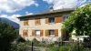
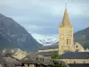
Embrun
| Municipality | Saint-André-d'Embrun |
|---|---|
| Postcode | 05200 |
| Latitude | 44.5864649 (N 44° 35’ 11”) |
| Longitude | 6.5347640 (E 6° 32’ 5”) |
| Altitude | From 796m to 2934m |
| Surface area | 38.63 km² |
| Population | 719 inhabitants |
| Density | 18 inhabitants/km² |
| Prefecture | Gap (45 km, 44 min) |
| Insee code | 05128 |
| Intercommunality | CC Serre-Ponçon |
| Department | Hautes-Alpes |
| Territories | Alps, Dauphiné |
| Region | Provence-Alps-French Riviera |
| Embrun | 6.6 km (12 min) |
|---|---|
| Baratier | 7.4 km (11 min) |
| Saint-Sauveur | 7.9 km (15 min) |
| Crots | 10.1 km (15 min) |
| Crévoux | 11.1 km (18 min) |
| Saint-Clément-sur-Durance | 12 km (18 min) |
| Puy-Sanières | 12.4 km (21 min) |
| Châteauroux-les-Alpes | 12.8 km (18 min) |
| Puy-Saint-Eusèbe | 14.7 km (26 min) |
| Savines-le-Lac | 14.7 km (18 min) |
| Réotier | 15.7 km (26 min) |
| Les Orres | 15.8 km (25 min) |
| Eygliers | 16.3 km (25 min) |
| Mont-Dauphin | 16.4 km (23 min) |
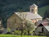
| Natural sites |
|---|
| Last name | Activity type | Rate | City |
|---|---|---|---|
 | Sports sensations | 38 € | Saint-Clément-sur-Durance (8 km) |
 | Sports sensations | 40 € | Saint-Clément-sur-Durance (8 km) |
 | Sports sensations | 41 € | Saint-Clément-sur-Durance (8.1 km) |
 | Nature and the great outdoors | 35 € | Risoul (10.9 km) |
 | Sports sensations | 45 € | Guillestre (12.3 km) |
| Last name | Outing type | Difficulty | Duration | Departure municipality |
|---|---|---|---|---|
 | Hike | Easy | 2:30 | Ancelle (25 km) |
 | Cycling itinerary | Athletic | 4:10 | Saint-Jean-Saint-Nicolas (26 km) |
 | Hike | Athletic | 3:00 | Ancelle (26 km) |
| Hike | Intermediate | 4:30 | Ancelle (26 km) |
 | Hike | Intermediate | 5:00 | Ancelle (26 km) |