

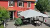
Favourite
Sundgau
| Municipality | Ruederbach |
|---|---|
| Postcode | 68560 |
| Latitude | 47.5634080 (N 47° 33’ 48”) |
| Longitude | 7.2695980 (E 7° 16’ 11”) |
| Altitude | From 335m to 424m |
| Surface area | 4.46 km² |
| Population | 410 inhabitants |
| Density | 91 inhabitants/km² |
| Prefecture | Colmar (70 km, 1:05) |
| Insee code | 68288 |
| Intercommunality | CC Sundgau |
| Department | Haut-Rhin |
| Territory | Alsace |
| Region | Great East |
| Bettendorf | 2.9 km (5 min) |
|---|---|
| Feldbach | 3.8 km (6 min) |
| Hirsingue | 4 km (7 min) |
| Heimersdorf | 5.7 km (7 min) |
| Illtal | 5.8 km (8 min) |
| Riespach | 5.9 km (10 min) |
| Hirtzbach | 6.8 km (11 min) |
| Bisel | 7.8 km (11 min) |
| Moernach | 7.9 km (10 min) |
| Koestlach | 8 km (13 min) |
| Waldighofen | 8.2 km (14 min) |
| Altkirch | 8.3 km (15 min) |
| Willer | 8.4 km (12 min) |
| Carspach | 8.8 km (13 min) |
| Last name | Outing type | Difficulty | Duration | Departure municipality |
|---|---|---|---|---|
 | Hike | Intermediate | 1:00 | Burnhaupt-le-Haut (21 km) |
 | Hike | Intermediate | 1:05 | Thann (30 km) |
 | Village visit | Easy | 1:00 | Masevaux-Niederbruck (31 km) |
 | Hike | Intermediate | 3:00 | Masevaux-Niederbruck (31 km) |
 | Hike | Intermediate | 35 min | Grand-Charmont (34 km) |