


Favourite
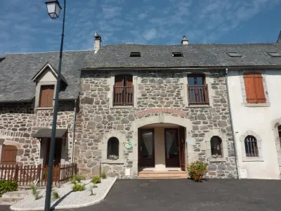
The site of Saint-Nazaire
| Municipality | Roche-le-Peyroux |
|---|---|
| Postcode | 19160 |
| Latitude | 45.4225470 (N 45° 25’ 21”) |
| Longitude | 2.3808670 (E 2° 22’ 51”) |
| Altitude | From 400m to 657m |
| Surface area | 7.15 km² |
| Population | 97 inhabitants |
| Density | 13 inhabitants/km² |
| Prefecture | Tulle (73 km, 56 min) |
| Insee code | 19175 |
| Intercommunality | CC Haute-Corrèze Communauté |
| Department | Corrèze |
| Territories | Limousin, Massif Central |
| Region | New-Aquitaine |
| Sainte-Marie-Lapanouze | 5 km (7 min) |
|---|---|
| Saint-Étienne-la-Geneste | 5.2 km (7 min) |
| Liginiac | 5.4 km (8 min) |
| Margerides | 7.9 km (13 min) |
| Saint-Victour | 10.3 km (16 min) |
| Chirac-Bellevue | 10.6 km (16 min) |
| Sarroux - Saint Julien | 11.2 km (16 min) |
| Veyrières | 11.8 km (19 min) |
| Mestes | 12.4 km (20 min) |
| Sérandon | 12.8 km (18 min) |
| Saint-Bonnet-près-Bort | 13.2 km (22 min) |
| Valiergues | 14.5 km (22 min) |
| Neuvic | 14.9 km (20 min) |
| Bort-les-Orgues | 16.6 km (22 min) |
| Last name | Activity type | Rate | City |
|---|---|---|---|
 | Sports sensations | 20 € | Lanobre (10.1 km) |
| Last name | Outing type | Difficulty | Duration | Departure municipality |
|---|---|---|---|---|
 | Hike | Intermediate | 2:00 | Veyrières (9.2 km) |
 | Hike | Intermediate | 2:30 | Saint-Genès-Champespe (27 km) |
 | Cycling itinerary | Intermediate | 40 min | Picherande (32 km) |
 | Cycling itinerary | Intermediate | 20 min | Murat-le-Quaire (35 km) |
 | Village visit | Easy | 1:00 | Fontanges (36 km) |