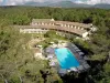


Favourite
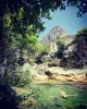
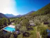
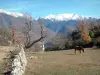
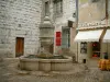
The Haut Pays
| Municipality | Revest-les-Roches |
|---|---|
| Postcode | 06830 |
| Latitude | 43.8815820 (N 43° 52’ 54”) |
| Longitude | 7.1567480 (E 7° 9’ 24”) |
| Altitude | From 138m to 1524m |
| Surface area | 8.61 km² |
| Population | 230 inhabitants |
| Density | 26 inhabitants/km² |
| Prefecture | Nice (42 km, 51 min) |
| Insee code | 06100 |
| Intercommunality | CC Alpes d'Azur |
| Department | Alpes-Maritimes |
| Territories | Alps, French Riviera |
| Region | Provence-Alps-French Riviera |
| Tourette-du-Château | 1.9 km (4 min) |
|---|---|
| Toudon | 5.4 km (10 min) |
| Gilette | 7.2 km (17 min) |
| Bonson | 8.9 km (16 min) |
| Les Ferres | 16.6 km (45 min) |
| Ascros | 17.1 km (28 min) |
| Saint-Martin-du-Var | 18.3 km (29 min) |
| Pierrefeu | 20 km (35 min) |
| La Roquette-sur-Var | 23 km (38 min) |
| Le Broc | 25 km (39 min) |
| Castagniers | 27 km (41 min) |
| Roquestéron | 27 km (41 min) |
| La Roque-en-Provence | 27 km (41 min) |
| Carros | 27 km (40 min) |
| Last name | Activity type | Rate | City |
|---|---|---|---|
 | Sports sensations | 30 € | Villars-sur-Var (8.8 km) |
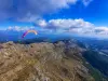 | Sports sensations | 90 € to 130 € | Gréolières (19.3 km) |
 | Sports sensations | 55 € | Gréolières (19.6 km) |
 | Entertainment | 42 € | Nice (22 km) |
 | Entertainment | 10 € | Nice (22 km) |
| Last name | Outing type | Difficulty | Duration | Departure municipality |
|---|---|---|---|---|
 | Hike | Athletic | 4:30 | Revest-les-Roches |
 | Hike | Intermediate | 4:30 | Tourette-du-Château (1.1 km) |
| Hike | Intermediate | 3:30 | Toudon (4.1 km) |
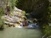 | Hike | Easy | 1:00 | Villars-sur-Var (7.8 km) |
 | Hike | Intermediate | 4:00 | Saint-Jeannet (15 km) |