Favourite
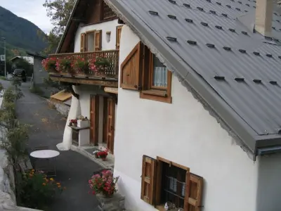
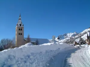
Briançon


| Municipality | Puy-Saint-Pierre |
|---|---|
| Postcode | 05100 |
| Latitude | 44.8929220 (N 44° 53’ 35”) |
| Longitude | 6.6179280 (E 6° 37’ 5”) |
| Altitude | From 1237m to 2538m |
| Surface area | 7.74 km² |
| Population | 535 inhabitants |
| Density | 69 inhabitants/km² |
| Prefecture | Gap (89 km, 1:25) |
| Insee code | 05109 |
| Intercommunality | CC du Briançonnais |
| Department | Hautes-Alpes |
| Territories | Alps, Dauphiné |
| Region | Provence-Alps-French Riviera |
| Puy-Saint-André | 2.9 km (6 min) |
|---|---|
| Briançon | 5.9 km (13 min) |
| Villar-Saint-Pancrace | 7.4 km (13 min) |
| Saint-Chaffrey | 9.1 km (16 min) |
| Saint-Martin-de-Queyrières | 12.3 km (18 min) |
| La Salle-les-Alpes | 12.9 km (20 min) |
| Val-des-Prés | 13.5 km (24 min) |
| Serre Chevalier | 14.3 km (23 min) |
| Cervières | 15.1 km (24 min) |
| Montgenèvre | 17.1 km (26 min) |
| Les Vigneaux | 18.3 km (25 min) |
| Le Monêtier-les-Bains | 19.1 km (26 min) |
| L'Argentière-la-Bessée | 19.2 km (23 min) |
| Puy-Saint-Vincent | 23 km (31 min) |


| Last name | Activity type | Rate | City |
|---|---|---|---|
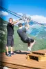
 | Nature and the great outdoors | 150 € to 220 € | Saint-Martin-de-Queyrières (6.3 km) |
 | Sports sensations | 30 € | L'Argentière-la-Bessée (10.7 km) |
 | Sports sensations | 45 € | Guillestre (26 km) |
 | Nature and the great outdoors | 35 € | Risoul (27 km) |
 | Sports sensations | 41 € | Saint-Clément-sur-Durance (27 km) |
| Last name | Outing type | Difficulty | Duration | Departure municipality |
|---|---|---|---|---|
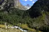
 | Hike | Intermediate | 3:30 | Névache (14.1 km) |
 | Hike | Intermediate | 4:30 | Névache (14.1 km) |
 | Hike | Intermediate | 3:20 | Saint-Christophe-en-Oisans (28 km) |
 | Hike | Athletic | 5:00 | Saint-Christophe-en-Oisans (31 km) |
 | Hike | Intermediate | 2:30 | Saint-Christophe-en-Oisans (32 km) |