


Favourite
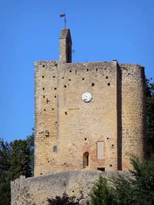
Vals rock church
| Municipality | Plaigne |
|---|---|
| Postcode | 11420 |
| Latitude | 43.1736090 (N 43° 10’ 25”) |
| Longitude | 1.8119380 (E 1° 48’ 43”) |
| Altitude | From 249m to 392m |
| Surface area | 13.19 km² |
| Population | 119 inhabitants |
| Density | 9 inhabitants/km² |
| Prefecture | Carcassonne (55 km, 52 min) |
| Insee code | 11290 |
| Intercommunality | CC Piège Lauragais Malepère |
| Department | Aude |
| Territory | Languedoc-Roussillon |
| Region | Occitanie |
| Pécharic-et-le-Py | 2.9 km (7 min) |
|---|---|
| Villautou | 3.7 km (6 min) |
| Cahuzac | 4.7 km (9 min) |
| Lafage | 4.9 km (10 min) |
| Pech-Luna | 6.4 km (12 min) |
| Belpech | 7.2 km (9 min) |
| Ribouisse | 7.7 km (13 min) |
| Gaja-la-Selve | 8.8 km (12 min) |
| Mayreville | 9.4 km (15 min) |
| Manses | 10.8 km (14 min) |
| Peyrefitte-sur-l'Hers | 10.8 km (17 min) |
| Gaudiès | 11.1 km (15 min) |
| Saint-Sernin | 11.2 km (18 min) |
| Lapenne | 11.5 km (16 min) |
| Last name | Activity type | Rate | City |
|---|---|---|---|
 | Sports sensations | 35 € to 40 € | Alet-les-Bains (41 km) |
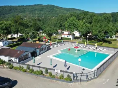
 | Nature and the great outdoors | 75 € to 576 € | Camarade (44 km) |
 | Culture and education | 11 € | Carcassonne (45 km) |
| Last name | Outing type | Difficulty | Duration | Departure municipality |
|---|---|---|---|---|
 | Mountain bike itinerary | Intermediate | 8:00 | Mirepoix (11 km) |
 | Hike | Intermediate | 2:00 | Belloc (20 km) |
 | Hike | Easy | 4:00 | La Bastide-de-Sérou (36 km) |
 | Hike | Easy | 3:00 | Verzeille (42 km) |
 | Car itinerary | Easy | 9:00 | Verzeille (42 km) |