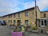
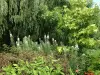
Visit the museum of tile and terracotta.


Favourite
| Municipality | Pargny-sur-Saulx |
|---|---|
| Postcode | 51340 |
| Tourism label | ") |
| Latitude | 48.7689750 (N 48° 46’ 8”) |
| Longitude | 4.8349920 (E 4° 50’ 6”) |
| Surface area | 12.44 km² |
| Population | 1738 inhabitants |
| Density | 139 inhabitants/km² |
| Prefecture | Châlons-en-Champagne (51 km, 49 min) |
| Insee code | 51423 |
| Intercommunality | CC Côtes de Champagne et Val de Saulx |
| Department | Marne |
| Territory | Champagne-Ardenne |
| Region | Great East |
| Étrepy | 2.3 km (4 min) |
|---|---|
| Maurupt-le-Montois | 3.2 km (7 min) |
| Heiltz-le-Maurupt | 3.8 km (6 min) |
| Bignicourt-sur-Saulx | 4.9 km (7 min) |
| Jussecourt-Minecourt | 5.8 km (9 min) |
| Sermaize-les-Bains | 6 km (7 min) |
| Sogny-en-l'Angle | 6.1 km (10 min) |
| Villers-le-Sec | 6.8 km (9 min) |
| Le Buisson | 6.9 km (8 min) |
| Blesme | 7.6 km (11 min) |
| Remennecourt | 8.8 km (11 min) |
| Saint-Lumier-la-Populeuse | 8.9 km (11 min) |
| Scrupt | 9 km (13 min) |
| Alliancelles | 9.1 km (12 min) |
Visit the museum of tile and terracotta.
| Last name | Outing type | Difficulty | Duration | Departure municipality |
|---|---|---|---|---|
 | Cycling itinerary | Easy | 3:05 | Vitry-le-François (18.9 km) |
 | Cycling itinerary | Easy | 3:00 | Giffaumont-Champaubert (25 km) |
 | All-terrain bike itinerary | Easy | 3:30 | Sainte-Menehould (36 km) |
 | Cycling itinerary | Intermediate | 2:20 | Sainte-Menehould (36 km) |
 | Hike | Easy | 1:50 | Montmorency-Beaufort (37 km) |