
Favourite
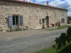
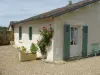
Montmorillon
| Municipality | Moulismes |
|---|---|
| Postcode | 86500 |
| Latitude | 46.3301100 (N 46° 19’ 48”) |
| Longitude | 0.8146620 (E 0° 48’ 53”) |
| Altitude | From 108m to 206m |
| Surface area | 29.06 km² |
| Population | 379 inhabitants |
| Density | 13 inhabitants/km² |
| Prefecture | Poitiers (49 km, 48 min) |
| Insee code | 86170 |
| Intercommunality | CC Vienne et Gartempe |
| Department | Vienne |
| Territory | Poitou |
| Region | New-Aquitaine |
| Plaisance | 4.8 km (8 min) |
|---|---|
| Saulgé | 8.4 km (10 min) |
| Persac | 9.3 km (15 min) |
| Adriers | 10.2 km (12 min) |
| Lussac-les-Châteaux | 11 km (11 min) |
| Montmorillon | 12 km (11 min) |
| Nérignac | 12 km (22 min) |
| Val-d'Oire-et-Gartempe | 13.1 km (12 min) |
| Mazerolles | 13.9 km (16 min) |
| Lathus-Saint-Rémy | 14.2 km (20 min) |
| Sillars | 15.2 km (14 min) |
| Queaux | 16.3 km (25 min) |
| Gouex | 17.4 km (20 min) |
| Moussac | 17.9 km (25 min) |
| Last name | Outing type | Difficulty | Duration | Departure municipality |
|---|---|---|---|---|
 | Cycling itinerary | Easy | 1:45 | Saulgé (7.1 km) |
 | Hike | Easy | 3:35 | Lathus-Saint-Rémy (7.2 km) |
 | Hike | Easy | 40 min | Lussac-les-Châteaux (10.6 km) |
 | All-terrain bike itinerary | Easy | 3:20 | Lussac-les-Châteaux (10.6 km) |
 | All-terrain bike itinerary | Easy | 2:30 | Lussac-les-Châteaux (10.6 km) |