Liven up your holidays!

Montigny-lès-Vaucouleurs

Tourism, holidays & weekends guide in the Meuse

Montigny-lès-Vaucouleurs - Tourism, holidays & weekends guide in the Meuse
8.8
6

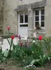
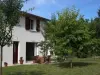
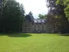
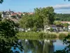
Located on the plateau overlooking the valley of the Meuse, upstream above Vaucouleurs, the village street typical of the Lorraine countryside is characterized by water. Formerly known as land of a thousand sources, it has a remarkable heritage of fountains, wash houses and gayoir (or égayoir). Capture water for consumption is located in a small valley at 1 km from the village in the forest and provides ample communal autonomy of people in water quality taste remarkable. Village entirely destroyed during the Thirty Years War by Swedish troops of mercenaries in the service of the King of France (we are yet at that time in the open French territory), it was rebuilt along the creek called ru Nicole. In the 18th century, a porcelain factory was established that produced for two centuries a quality earthenware (faience blue) due to the type of clay existing in the territory. This factory was up to 25 workers and then died out in the early 20th century during the development of major industries of Luneville faience, St. Clement, Sarreguemines. Some buildings remain in the village and can be discovered while walking around the visible traces of the old clay mines open.

Geographical information

MunicipalityMontigny-lès-Vaucouleurs
Postcode55140
Latitude48.5883040 (N 48° 35’ 18”)
Longitude5.6322690 (E 5° 37’ 56”)
AltitudeFrom 280m to 381m
Surface area11.83 km²
Population76 inhabitants
Density6 inhabitants/km²
PrefectureBar-le-Duc (54 km, 51 min)
Insee code55350
IntercommunalityCC de Commercy - Void - Vaucouleurs
DepartmentMeuse
TerritoryLorraine
RegionGreat East

Nearest cities & towns

Vaucouleurs4.5 km (7 min)
Chalaines5.7 km (8 min)
Neuville-lès-Vaucouleurs6.6 km (8 min)
Mauvages7.5 km (9 min)
Burey-en-Vaux8.3 km (9 min)
Rigny-la-Salle8.5 km (12 min)
Rigny-Saint-Martin9.3 km (11 min)
Delouze-Rosières9.5 km (9 min)
Sepvigny9.6 km (12 min)
Villeroy-sur-Méholle10 km (13 min)
Ugny-sur-Meuse10.9 km (15 min)
Badonvilliers-Gérauvilliers11.4 km (13 min)
Maxey-sur-Vaise11.4 km (13 min)
Champougny11.7 km (16 min)

Things to see and do

Places of interest

Natural sites

Events and festivities

Large flea market in June. See the specific dates with the Festival Committee of the village.

Photos

The End of Autumn
The End of Autumn
See photo
Fountain in the mirror
See photo
The undergrowth in summer
See photo
Lavoir-gayoir
Lavoir-gayoir
See photo
And in winter ...
And in winter ...
See photo
Church
Church
See photo
Joan of Arc
Joan of Arc
See photo
City Hall, church in the powder
See photo

Weather

Thursday 25 april
Min. 2°C - Max. 10°C
Day
Night
Friday 26 april
Min. 5°C - Max. 13°C
Day
Night
Saturday 27 april
Min. 7°C - Max. 16°C
Day
Night

Visits, leisure and activities nearby

Leisure activities

Last nameActivity typeRateCity
Shop selling local and regional products
Local flavoursFreeSorcy-Saint-Martin (13.8 km)
Making an egg in a glass artist's studio
Arts and CraftsFreeHeudicourt-sous-les-Côtes (38 km)

Outings

Last nameOuting typeDifficultyDurationDeparture municipality
In the footsteps of Jeanne, around Domremy
HikeIntermediate3:20Maxey-sur-Meuse (16 km)
Walk around Neufchateau
HikeEasy1:55Neufchâteau (26 km)
Villey-Saint-Étienne structures
HikeEasy2:00Villey-Saint-Étienne (30 km)
Tour of Flirey
Village visitEasy1:00Flirey (36 km)
Tour of Liverdun
HikeEasy2:00Liverdun (36 km)

Restaurants

Bed & breakfasts

Vacation rentals

Campsites

Hotels

Your holidays
A hotel
A vacation rental
A bed & breakfast
A campsite
A leisure activity
A restaurant
A rental car
A plane ticket
By continuing to browse our site, you are agreeing to the use of cookies to improve your experience and make targeted offers.
Find out more and make settings
Your account