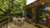
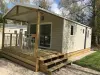
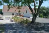
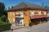
Liven up your holidays!

Montcourt

Tourism, holidays & weekends guide in the Haute-Saône

Montcourt - Tourism, holidays & weekends guide in the Haute-Saône
8.1
2

Geographical information

MunicipalityMontcourt
Postcode70500
Latitude47.9299540 (N 47° 55’ 48”)
Longitude5.9578020 (E 5° 57’ 28”)
AltitudeFrom 224m to 310m
Surface area4.92 km²
Population56 inhabitants
Density11 inhabitants/km²
PrefectureVesoul (46 km, 51 min)
Insee code70359
IntercommunalityCC des Hauts du Val de Saône
DepartmentHaute-Saône
TerritoryFranche-Comté
RegionBurgundy-Franche-Comté

Nearest cities & towns

Bourbévelle1.8 km (4 min)
Ameuvelle3 km (5 min)
Vougécourt3.4 km (5 min)
Jonvelle3.5 km (6 min)
Corre3.9 km (5 min)
Ranzevelle4.7 km (7 min)
Bousseraucourt5.2 km (7 min)
Villars-le-Pautel5.7 km (10 min)
Grignoncourt6.8 km (9 min)
Châtillon-sur-Saône7.6 km (7 min)
Demangevelle7.8 km (8 min)
Passavant-la-Rochère8 km (12 min)
Aisey-et-Richecourt8.2 km (9 min)
Regnévelle8.7 km (11 min)

Photos

Church square, at Montcourt (© JE)
See photo
Notre-Dame church
Notre-Dame church
See photo
Fountain-washhouse, near the church (© JE)
See photo
Church of the Nativity of Notre-Dame (© JE)
See photo
Town hall of Montcourt (© JE)
See photo
Basin of the large fountain-washhouse (© JE)
See photo
Large fountain-washhouse (© JE)
See photo
Large fountain-washhouse (© JE)
See photo
Engraved stone, inserted in a wall of the town hall (© JE)
See photo
The town
The town
See photo
The town
The town
See photo
The town
The town
See photo
The Notre-Dame church
See photo
War memorial
War memorial
See photo

Weather

Thursday 18 april
Min. 2°C - Max. 10°C
Day
Night
Friday 19 april
Min. 1°C - Max. 9°C
Day
Night
Saturday 20 april
Min. 5°C - Max. 11°C
Day
Night

Visits, leisure and activities nearby

Outings

Last nameOuting typeDifficultyDurationDeparture municipality
To the Sources of Saint-Remy
HikeIntermediate3:30Saint-Rémy-en-Comté (14.7 km)
Solitary Bonneval
HikeEasy2:00Relanges (21 km)
Tour 4: La Bourguignotte
HikeIntermediate2:10La Vôge-les-Bains (24 km)
Circuit of Princes of Beaufremont
HikeEasy2:05Scey-sur-Saône-et-Saint-Albin (29 km)
Interpretation circuit of the Rives de Saône
HikeEasy1:05Ferrières-lès-Scey (31 km)

Restaurants

Bed & breakfasts

Vacation rentals

Campsites

Hotels

Your holidays
A hotel
A vacation rental
A bed & breakfast
A campsite
A leisure activity
A restaurant
A rental car
A plane ticket
By continuing to browse our site, you are agreeing to the use of cookies to improve your experience and make targeted offers.
Find out more and make settings
Your account