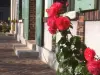
Favourite
Bonneval
| Municipality | Dangeau |
|---|---|
| Postcode | 28160 |
| Latitude | 48.2086860 (N 48° 12’ 31”) |
| Longitude | 1.2875570 (E 1° 17’ 15”) |
| Altitude | From 130m to 184m |
| Surface area | 54.88 km² |
| Population | 1276 inhabitants |
| Density | 23 inhabitants/km² |
| Prefecture | Chartres (32 km, 36 min) |
| Insee code | 28127 |
| Intercommunality | CC du Bonnevalais |
| Department | Eure-et-Loir |
| Territory | Perche |
| Region | Centre-Loire Valley |
| Montharville | 4.8 km (6 min) |
|---|---|
| Saumeray | 5.5 km (6 min) |
| Trizay-lès-Bonneval | 5.6 km (10 min) |
| Yèvres | 7.4 km (7 min) |
| Logron | 7.6 km (8 min) |
| Gohory | 7.8 km (11 min) |
| Saint-Avit-les-Guespières | 8 km (8 min) |
| Bonneval | 9.3 km (10 min) |
| Brou | 9.5 km (11 min) |
| Alluyes | 9.6 km (10 min) |
| Charonville | 9.7 km (13 min) |
| Montboissier | 10 km (14 min) |
| Bouville | 10.5 km (14 min) |
| Illiers-Combray | 11.2 km (12 min) |
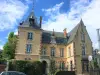
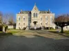
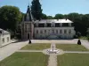
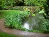
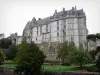
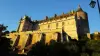
| Monuments |
|---|
| Last name | Activity type | Rate | City |
|---|---|---|---|
 | Sports sensations | 22 € to 75 € | Fontaine-Simon (39 km) |
| Last name | Outing type | Difficulty | Duration | Departure municipality |
|---|---|---|---|---|
 | Village visit | Easy | 1:00 | Châteaudun (15.6 km) |
 | Hike | Easy | 3:00 | Châteaudun (15.7 km) |
 | Hike | Intermediate | 2:45 | Nonvilliers-Grandhoux (17.4 km) |
| Cycling itinerary | Easy | 2:00 | Lunay (52 km) |