

Favourite
Baccarat and its crystal glassworks
| Municipality | Mattexey |
|---|---|
| Postcode | 54830 |
| Latitude | 48.4434840 (N 48° 26’ 37”) |
| Longitude | 6.5147420 (E 6° 30’ 53”) |
| Altitude | From 270m to 337m |
| Surface area | 4.97 km² |
| Population | 69 inhabitants |
| Density | 13 inhabitants/km² |
| Prefecture | Nancy (50 km, 44 min) |
| Insee code | 54356 |
| Intercommunality | CC Meurthe Mortagne Moselle |
| Department | Meurthe-et-Moselle |
| Territory | Lorraine |
| Region | Great East |
| Seranville | 1.8 km (4 min) |
|---|---|
| Giriviller | 2.3 km (4 min) |
| Magnières | 4.1 km (5 min) |
| Vennezey | 4.6 km (7 min) |
| Clézentaine | 5 km (7 min) |
| Saint-Pierremont | 5.3 km (6 min) |
| Remenoville | 6.3 km (8 min) |
| Vallois | 6.5 km (9 min) |
| Gerbéviller | 6.6 km (12 min) |
| Deinvillers | 6.6 km (10 min) |
| Essey-la-Côte | 6.9 km (10 min) |
| Rozelieures | 7.1 km (9 min) |
| Haudonville | 7.8 km (14 min) |
| Moyen | 8.7 km (10 min) |
| Last name | Activity type | Rate | City |
|---|---|---|---|
 | Culture and education | 12 € | Laveline-devant-Bruyères (34 km) |
 | Entertainment | Free | Xonrupt-Longemer (50 km) |
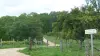
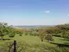
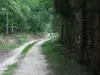
| Last name | Outing type | Difficulty | Duration | Departure municipality |
|---|---|---|---|---|
 | Hike | Easy | 3:30 | Charmois (14.4 km) |
 | Hike | Easy | 2:00 | Blainville-sur-l'Eau (15.2 km) |
 | Hike | Intermediate | 5:00 | Charmes (18.2 km) |
 | Hike | Easy | 1:30 | Vigneulles (19 km) |
 | Hike | Easy | 2:30 | Deyvillers (27 km) |