- Geographic location :
- East of Nîmes, towards Avignon, the commune of Marguerittes is divided between plain and scrubland. The old village is mainly concentrated on the plain, south of the RN86.
- History:
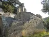
- Ancient Gallo-Roman villa, named Sandus-Egidius, finally became Marguerittes in 1435, finds its center around the Saint-Pierre church, but when it is destroyed in the 15th century, the village develops around the castle and his chapel.
- The oldest indices of human occupation at Marguerittes date back to prehistory. The plain is then a hunting, gathering and fishing reserve because of the presence of marshes, springs and rivers.
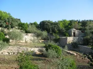
- In Roman times, the plain and part of the scrubland of Marguerittes are the granary of the city of Nîmes. This explains the presence of many "villae" scattered on its territory. Thus, Marguerittes, small fortified village with a castle, ramparts and several houses, is surrounded in the plain of densely populated hamlets, like Agarne, Couloures, Saint Gilles, Quart, Luc, Costabalen. In 1570, Marguerittes is taken by Protestants, but is released 3 years later by Catholics. Multiple conflicts affect the local economy as much as the morale of the inhabitants.
- In 1722, the plague epidemic reappeared on the town, leaving behind 280 dead, almost a quarter of the population.
- In the 19th century, the village grew very quickly. It is then necessary to face the capacities of reception, because each year the village increases of a hundred inhabitants.