

Favourite
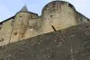
Villy-La Ferté Fort
| Municipality | Malandry |
|---|---|
| Postcode | 08370 |
| Latitude | 49.5788510 (N 49° 34’ 44”) |
| Longitude | 5.1950990 (E 5° 11’ 42”) |
| Surface area | 6.87 km² |
| Population | 79 inhabitants |
| Density | 11 inhabitants/km² |
| Prefecture | Charleville-Mézières (51 km, 46 min) |
| Insee code | 08269 |
| Intercommunality | CC des Portes du Luxembourg |
| Department | Ardennes |
| Territory | Champagne-Ardenne |
| Region | Great East |
| Villy | 3 km (5 min) |
|---|---|
| Sailly | 4.6 km (8 min) |
| Inor | 5.4 km (9 min) |
| La Ferté-sur-Chiers | 5.4 km (9 min) |
| Blagny | 5.9 km (10 min) |
| Martincourt-sur-Meuse | 6.9 km (10 min) |
| Margut | 7.1 km (10 min) |
| Olizy-sur-Chiers | 7.7 km (12 min) |
| Luzy-Saint-Martin | 8.2 km (13 min) |
| Carignan | 8.2 km (13 min) |
| Linay | 8.6 km (12 min) |
| Autréville-Saint-Lambert | 8.7 km (13 min) |
| Moiry | 9 km (14 min) |
| Last name | Activity type | Rate | City |
|---|---|---|---|
 | Local flavours | Free | Douzy (15.3 km) |
| Last name | Outing type | Difficulty | Duration | Departure municipality |
|---|---|---|---|---|
 | Hike | Intermediate | 2:00 | Vaux-lès-Mouzon (5.8 km) |
| Village visit | Easy | 1:30 | Vaux-lès-Mouzon (5.8 km) |
 | All-terrain bike itinerary | Intermediate | 4:35 | Sedan (23 km) |
 | Hike | Easy | 2:00 | Charleville-Mézières (40 km) |
 | Hike | Intermediate | 2:40 | Charleville-Mézières (40 km) |