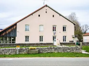
Situated on a plain and the slope Dessessart, the town is extensive. The village has typical farms and many property line "standing stones".


Favourite


Situated on a plain and the slope Dessessart, the town is extensive. The village has typical farms and many property line "standing stones".
| Municipality | Les Plains-et-Grands-Essarts |
|---|---|
| Postcode | 25470 |
| Latitude | 47.3034210 (N 47° 18’ 12”) |
| Longitude | 6.8933600 (E 6° 53’ 36”) |
| Altitude | From 626m to 933m |
| Surface area | 10.35 km² |
| Population | 219 inhabitants |
| Density | 21 inhabitants/km² |
| Prefecture | Besançon (85 km, 1:23) |
| Insee code | 25458 |
| Intercommunality | CC du Pays de Maîche |
| Department | Doubs |
| Territories | Franche-Comté, Jura mountains |
| Region | Burgundy-Franche-Comté |
| Courtefontaine | 3.4 km (6 min) |
|---|---|
| Trévillers | 3.5 km (5 min) |
| Thiébouhans | 5.1 km (7 min) |
| Indevillers | 5.4 km (7 min) |
| Ferrières-le-Lac | 6.6 km (10 min) |
| Fessevillers | 7.3 km (11 min) |
| Belfays | 7.8 km (13 min) |
| Cernay-l'Église | 8.1 km (13 min) |
| Damprichard | 8.4 km (13 min) |
| Les Bréseux | 8.5 km (12 min) |
| Montandon | 8.8 km (16 min) |
| Burnevillers | 10.2 km (16 min) |
| Vaufrey | 10.2 km (21 min) |
| Urtière | 10.5 km (20 min) |
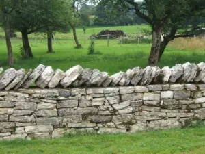
Panorama barrier Girodey.
Hiking in no Saint-André and Cave Women Green with a key passage in the village, the Vaucluse fountain.
A greengrocer County.


| Last name | Outing type | Difficulty | Duration | Departure municipality |
|---|---|---|---|---|
 | Hike | Intermediate | 35 min | Grand-Charmont (25 km) |
 | Hike | Easy | 1:00 | Pays-de-Clerval (32 km) |
 | Hike | Intermediate | 35 min | Hauterive-la-Fresse (49 km) |
 | Hike | Intermediate | 1:00 | Burnhaupt-le-Haut (51 km) |
 | Village visit | Easy | 1:00 | Masevaux-Niederbruck (53 km) |


