

Favourite
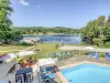
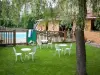
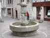
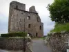
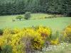
Ussel
| Municipality | Lamazière-Haute |
|---|---|
| Postcode | 19340 |
| Latitude | 45.6698760 (N 45° 40’ 12”) |
| Longitude | 2.3976550 (E 2° 23’ 52”) |
| Altitude | From 746m to 916m |
| Surface area | 15.31 km² |
| Population | 70 inhabitants |
| Density | 4 inhabitants/km² |
| Prefecture | Tulle (92 km, 1:09) |
| Insee code | 19103 |
| Intercommunality | CC Haute-Corrèze Communauté |
| Department | Corrèze |
| Territories | Limousin, Massif Central |
| Region | New-Aquitaine |
| Eygurande | 4.7 km (8 min) |
|---|---|
| Courteix | 6.8 km (13 min) |
| Monestier-Merlines | 7.4 km (14 min) |
| Merlines | 7.6 km (14 min) |
| Couffy-sur-Sarsonne | 7.6 km (11 min) |
| Feyt | 9.3 km (17 min) |
| Saint-Pardoux-le-Neuf | 11.4 km (20 min) |
| Aix | 11.8 km (20 min) |
| Saint-Rémy | 13.4 km (18 min) |
| Saint-Martial-le-Vieux | 13.6 km (19 min) |
| Saint-Oradoux-de-Chirouze | 14.6 km (28 min) |
| Bourg-Lastic | 15 km (19 min) |
| Messeix | 15.4 km (25 min) |
| Flayat | 16.3 km (30 min) |
| Last name | Activity type | Rate | City |
|---|---|---|---|
 | Sports sensations | 20 € | Lanobre (27 km) |
 | Nature and the great outdoors | 7 € | Chapdes-Beaufort (44 km) |
| Last name | Outing type | Difficulty | Duration | Departure municipality |
|---|---|---|---|---|
 | Cycling itinerary | Intermediate | 20 min | Murat-le-Quaire (29 km) |
 | Cycling itinerary | Athletic | 35 min | Mont-Dore (35 km) |
 | Cycling itinerary | Intermediate | 4:35 | Miremont (35 km) |
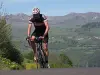 | Cycling itinerary | Intermediate | 40 min | Picherande (36 km) |
 | Hike | Intermediate | 2:00 | Veyrières (37 km) |