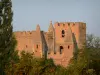
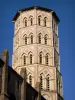
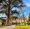
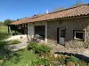
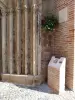
13th century church.
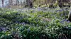
Several hiking trails.
| Municipality | Lamaguère |
|---|---|
| Postcode | 32260 |
| Latitude | 43.4911030 (N 43° 29’ 28”) |
| Longitude | 0.6728250 (E 0° 40’ 22”) |
| Altitude | From 191m to 297m |
| Surface area | 6.49 km² |
| Population | 80 inhabitants |
| Density | 12 inhabitants/km² |
| Prefecture | Auch (24 km, 28 min) |
| Insee code | 32186 |
| Intercommunality | CC Val de Gers |
| Department | Gers |
| Territories | Gascony, Midi-Pyrénées |
| Region | Occitanie |
| Tachoires | 2.4 km (4 min) |
|---|---|
| Monferran-Plavès | 3.4 km (9 min) |
| Faget-Abbatial | 3.5 km (8 min) |
| Moncorneil-Grazan | 5 km (7 min) |
| Pouy-Loubrin | 7.7 km (12 min) |
| Lartigue | 7.8 km (12 min) |
| Betcave-Aguin | 8 km (11 min) |
| Traversères | 8.6 km (13 min) |
| Simorre | 9 km (12 min) |
| Haulies | 9.4 km (12 min) |
| Seissan | 9.6 km (12 min) |
| Sémézies-Cachan | 9.8 km (11 min) |
| Bellegarde | 9.9 km (15 min) |
| Sère | 9.9 km (14 min) |
13th century church.
Several hiking trails.
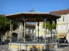
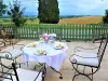
The last weekend in July, the Feast of the village and its garage sale.
Every two years in even years, the biennial square format (visual arts exhibition).
| Last name | Activity type | Rate | City |
|---|---|---|---|
 | Sports sensations | 15 € to 25 € | Lannemezan (49 km) |
| Last name | Outing type | Difficulty | Duration | Departure municipality |
|---|---|---|---|---|
 | Hike | Intermediate | 3:25 | Castelnau-Barbarens (10.3 km) |
 | Hike | Easy | 35 min | Lombez (19.2 km) |
 | Hike | Easy | 2:30 | Bazian (34 km) |
 | Village visit | Intermediate | 2:00 | Carbonne (50 km) |
 | Hike | Intermediate | 3:00 | Bize (52 km) |