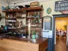

Favourite
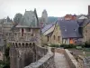
Fougères


| Municipality | La Selle-en-Luitré |
|---|---|
| Postcode | 35133 |
| Tourism label | ") |
| Latitude | 48.3101879 (N 48° 18’ 37”) |
| Longitude | -1.1275050 (W 1° 7’ 39”) |
| Altitude | From 70m to 122m |
| Surface area | 7.32 km² |
| Population | 633 inhabitants |
| Density | 86 inhabitants/km² |
| Prefecture | Rennes (60 km, 49 min) |
| Insee code | 35324 |
| Intercommunality | CA Fougères Agglomération |
| Department | Ille-et-Vilaine |
| Region | Brittany |
| Fleurigné | 3.6 km (8 min) |
|---|---|
| Luitré-Dompierre | 4.4 km (7 min) |
| Beaucé | 4.6 km (8 min) |
| La Pellerine | 6.4 km (9 min) |
| La Chapelle-Janson | 6.5 km (11 min) |
| Javené | 7.6 km (10 min) |
| Fougères | 9.4 km (13 min) |
| Laignelet | 10.9 km (13 min) |
| Saint-Pierre-des-Landes | 11.5 km (16 min) |
| Billé | 12.3 km (16 min) |
| Parcé | 12.9 km (19 min) |
| Lécousse | 13.4 km (16 min) |
| Le Loroux | 13.4 km (20 min) |
| Larchamp | 13.8 km (20 min) |
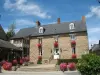
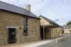
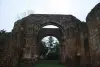
| Monuments | |
|---|---|
| Performance halls |
| Last name | Activity type | Rate | City |
|---|---|---|---|
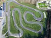 | Sports sensations | 16 € to 24 € | Le Neufbourg (42 km) |
 | Sports sensations | 100 € | Le Val-Saint-Père (44 km) |
 | Sports sensations | 140 € | Le Val-Saint-Père (44 km) |
| Last name | Outing type | Difficulty | Duration | Departure municipality |
|---|---|---|---|---|
 | Hike | Intermediate | 2:10 | La Bouëxière (27 km) |
 | Hike | Intermediate | 2:00 | Ercé-près-Liffré (29 km) |
 | Hike | Easy | 2:00 | Liffré (34 km) |
 | Hike | Intermediate | 2:00 | Saint-Sulpice-la-Forêt (35 km) |
 | Car itinerary | Easy | 4:00 | Saint-Cyr-du-Bailleul (37 km) |