


Favourite
Vesoul
| Municipality | La Malachère |
|---|---|
| Postcode | 70190 |
| Latitude | 47.4517520 (N 47° 27’ 6”) |
| Longitude | 6.0739060 (E 6° 4’ 26”) |
| Altitude | From 269m to 380m |
| Surface area | 5.46 km² |
| Population | 310 inhabitants |
| Density | 56 inhabitants/km² |
| Prefecture | Vesoul (25 km, 23 min) |
| Insee code | 70326 |
| Intercommunality | CC du Pays Riolais |
| Department | Haute-Saône |
| Territory | Franche-Comté |
| Region | Burgundy-Franche-Comté |
| Rioz | 3.1 km (5 min) |
|---|---|
| Trésilley | 3.8 km (9 min) |
| Hyet | 4 km (6 min) |
| Quenoche | 4 km (6 min) |
| Pennesières | 5.4 km (6 min) |
| Traitiéfontaine | 5.5 km (9 min) |
| Neuvelle-lès-Cromary | 6.8 km (10 min) |
| Ruhans | 7.1 km (10 min) |
| Sorans-lès-Breurey | 7.3 km (11 min) |
| Fondremand | 9.2 km (12 min) |
| Villers-Pater | 10.2 km (13 min) |
| Cirey | 10.6 km (17 min) |
| Le Magnoray | 10.7 km (17 min) |
| Chambornay-lès-Bellevaux | 10.8 km (15 min) |
| Last name | Activity type | Rate | City |
|---|---|---|---|
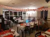
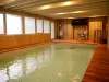
 | Entertainment | 84 € to 110 € | Besançon (24 km) |
| Last name | Outing type | Difficulty | Duration | Departure municipality |
|---|---|---|---|---|
 | Hike | Athletic | 5:05 | Fretigney-et-Velloreille (10.1 km) |
 | Hike | Easy | 6:00 | Devecey (14.8 km) |
 | Hike | Intermediate | 1:20 | Bucey-lès-Gy (17.3 km) |
 | Hike | Easy | 2:35 | Bucey-lès-Gy (17.9 km) |
 | Hike | Intermediate | 2:30 | Gy (20 km) |