
Favourite
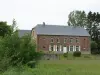
Bavay


| Municipality | La Flamengrie |
|---|---|
| Postcode | 59570 |
| Latitude | 50.3146520 (N 50° 18’ 53”) |
| Longitude | 3.7158060 (E 3° 42’ 57”) |
| Altitude | From 108m to 132m |
| Surface area | 2.03 km² |
| Population | 440 inhabitants |
| Density | 216 inhabitants/km² |
| Prefecture | Lille (71 km, 48 min) |
| Insee code | 59232 |
| Intercommunality | CC du Pays de Mormal |
| Department | Nord |
| Territory | Flandre-Artois |
| Region | Hauts-de-France |
| Saint-Waast | 3.7 km (6 min) |
|---|---|
| Bettrechies | 3.8 km (6 min) |
| Eth | 4.2 km (10 min) |
| Amfroipret | 5 km (10 min) |
| Bellignies | 5.3 km (9 min) |
| Bermeries | 5.5 km (10 min) |
| Wargnies-le-Petit | 5.9 km (8 min) |
| Gussignies | 6.2 km (13 min) |
| Gommegnies | 7.1 km (11 min) |
| Sebourg | 7.3 km (16 min) |
| Bry | 7.3 km (10 min) |
| Preux-au-Sart | 7.5 km (10 min) |
| Houdain-lez-Bavay | 7.9 km (9 min) |
| Bavay | 7.9 km (8 min) |


| Last name | Outing type | Difficulty | Duration | Departure municipality |
|---|---|---|---|---|
 | Hike | Easy | 20 min | Cambrai (38 km) |