

Favourite
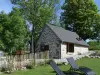
Néris-les-Bains
| Municipality | La Crouzille |
|---|---|
| Postcode | 63700 |
| Latitude | 46.1809050 (N 46° 10’ 51”) |
| Longitude | 2.7454230 (E 2° 44’ 44”) |
| Altitude | From 491m to 663m |
| Surface area | 18.60 km² |
| Population | 269 inhabitants |
| Density | 14 inhabitants/km² |
| Prefecture | Clermont-Ferrand (75 km, 1:10) |
| Insee code | 63130 |
| Intercommunality | CC du Pays de Saint-Éloy |
| Department | Puy-de-Dôme |
| Territories | Auvergne, Massif Central |
| Region | Auvergne-Rhône-Alps |
| Ars-les-Favets | 1.9 km (4 min) |
|---|---|
| Montaigut-en-Combraille | 5.3 km (7 min) |
| Virlet | 5.9 km (9 min) |
| Ronnet | 6.6 km (9 min) |
| Saint-Éloy-les-Mines | 8.6 km (11 min) |
| Le Quartier | 8.7 km (15 min) |
| Arpheuilles-Saint-Priest | 9.5 km (13 min) |
| Marcillat-en-Combraille | 9.7 km (10 min) |
| Buxières-sous-Montaigut | 9.8 km (11 min) |
| Durdat-Larequille | 9.9 km (11 min) |
| La Celle | 10 km (13 min) |
| Youx | 10.3 km (14 min) |
| Pionsat | 10.7 km (18 min) |
| Lapeyrouse | 12.1 km (12 min) |
| Last name | Activity type | Rate | City |
|---|---|---|---|
 | Nature and the great outdoors | 7 € | Chapdes-Beaufort (33 km) |
 | Nature and the great outdoors | 140 € to 240 € | Volvic (41 km) |
 | Nature and the great outdoors | 8 € to 50 € | Noyant-d'Allier (44 km) |
| Last name | Outing type | Difficulty | Duration | Departure municipality |
|---|---|---|---|---|
 | Village visit | Easy | 1:00 | Servant (14.8 km) |
 | Hike | Intermediate | 1:30 | Saint-Rémy-de-Blot (18.3 km) |
 | Car itinerary | Easy | 1:35 | Évaux-les-Bains (20 km) |
 | Hike | Easy | 2:00 | Évaux-les-Bains (20 km) |
 | Hike | Intermediate | 2:20 | Évaux-les-Bains (20 km) |