


Favourite
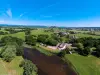
The Beuvray mount
| Municipality | La Comelle |
|---|---|
| Postcode | 71990 |
| Latitude | 46.8802260 (N 46° 52’ 49”) |
| Longitude | 4.1112339 (E 4° 6’ 40”) |
| Altitude | From 283m to 446m |
| Surface area | 22.73 km² |
| Population | 251 inhabitants |
| Density | 11 inhabitants/km² |
| Prefecture | Mâcon (119 km, 1:43) |
| Insee code | 71142 |
| Intercommunality | CC du Grand Autunois Morvan |
| Department | Saône-et-Loire |
| Territory | Burgundy |
| Region | Burgundy-Franche-Comté |
| Saint-Léger-sous-Beuvray | 6.5 km (11 min) |
|---|---|
| Poil | 6.6 km (11 min) |
| Saint-Didier-sur-Arroux | 7.3 km (12 min) |
| Étang-sur-Arroux | 7.4 km (10 min) |
| Thil-sur-Arroux | 11.1 km (18 min) |
| Saint-Prix | 11.2 km (18 min) |
| Laizy | 11.6 km (14 min) |
| Mesvres | 12.1 km (15 min) |
| Brion | 12.5 km (15 min) |
| Millay | 12.6 km (15 min) |
| La Grande-Verrière | 13 km (18 min) |
| La Chapelle-sous-Uchon | 13.3 km (18 min) |
| Charbonnat | 13.4 km (21 min) |
| Larochemillay | 13.9 km (23 min) |
| Natural sites |
|---|
| Last name | Outing type | Difficulty | Duration | Departure municipality |
|---|---|---|---|---|
 | Hike | Intermediate | 1:30 | La Comelle |
 | Hike | Intermediate | 2:00 | La Comelle |
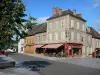
 | Village visit | Easy | 2:30 | La Comelle |
 | Hike | Easy | 2:00 | Saint-Léger-sous-Beuvray (4.8 km) |
 | Hike | Easy | 3:00 | Saint-Léger-sous-Beuvray (4.8 km) |