

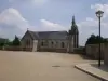
Favourite
Lannion
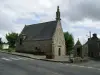
| Municipality | La Chapelle-Neuve |
|---|---|
| Postcode | 22160 |
| Latitude | 48.4617650 (N 48° 27’ 42”) |
| Longitude | -3.4207900 (W 3° 25’ 15”) |
| Altitude | From 184m to 304m |
| Surface area | 23.78 km² |
| Population | 388 inhabitants |
| Density | 16 inhabitants/km² |
| Prefecture | Saint-Brieuc (66 km, 52 min) |
| Insee code | 22037 |
| Intercommunality | CA Guingamp-Paimpol Agglomération de l'Armor à l'Argoat |
| Department | Côtes-d'Armor |
| Region | Brittany |
| Plougonver | 4.6 km (6 min) |
|---|---|
| Calanhel | 6.7 km (9 min) |
| Callac | 7.6 km (12 min) |
| Loc-Envel | 8.1 km (12 min) |
| Lohuec | 10.1 km (14 min) |
| Loguivy-Plougras | 11.2 km (16 min) |
| Belle-Isle-en-Terre | 11.8 km (12 min) |
| Gurunhuel | 12.1 km (14 min) |
| Plourac'h | 12.9 km (17 min) |
| Duault | 13.9 km (20 min) |
| Plusquellec | 14.6 km (19 min) |
| Bolazec | 15.6 km (21 min) |
| Plounévez-Moëdec | 15.9 km (19 min) |
| Last name | Outing type | Difficulty | Duration | Departure municipality |
|---|---|---|---|---|
 | Hike | Easy | 20 min | Loguivy-Plougras (5.5 km) |
 | Hike | Intermediate | 2:35 | Loguivy-Plougras (5.5 km) |
 | Hike | Easy | 55 min | Plougras (9.4 km) |
 | Hike | Intermediate | 3:05 | Bolazec (12.2 km) |
 | Hike | Easy | 2:15 | Plounérin (14.6 km) |