


Favourite
The triptychs of Ternant
| Municipality | La Chapelle-au-Mans |
|---|---|
| Postcode | 71130 |
| Latitude | 46.6272270 (N 46° 37’ 38”) |
| Longitude | 3.9720110 (E 3° 58’ 19”) |
| Altitude | From 255m to 401m |
| Surface area | 27.50 km² |
| Population | 235 inhabitants |
| Density | 8 inhabitants/km² |
| Prefecture | Mâcon (93 km, 1:28) |
| Insee code | 71088 |
| Intercommunality | CC Entre Arroux, Loire et Somme |
| Department | Saône-et-Loire |
| Territory | Burgundy |
| Region | Burgundy-Franche-Comté |
| Curdin | 4.7 km (9 min) |
|---|---|
| Neuvy-Grandchamp | 6.1 km (8 min) |
| Grury | 7.9 km (12 min) |
| Uxeau | 9.7 km (12 min) |
| Gueugnon | 10.5 km (15 min) |
| Issy-l'Évêque | 10.8 km (14 min) |
| Cressy-sur-Somme | 12.5 km (20 min) |
| Chalmoux | 13.4 km (12 min) |
| Vendenesse-sur-Arroux | 13.6 km (19 min) |
| Les Guerreaux | 14.7 km (20 min) |
| Clessy | 15.2 km (20 min) |
| Marly-sous-Issy | 15.6 km (22 min) |
| Sainte-Radegonde | 15.6 km (22 min) |
| La Motte-Saint-Jean | 16.1 km (22 min) |
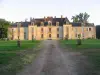
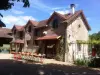
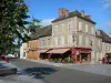
| Monuments |
|---|
| Last name | Outing type | Difficulty | Duration | Departure municipality |
|---|---|---|---|---|
 | Hike | Intermediate | 3:00 | La Boulaye (17.8 km) |
 | Hike | Easy | 1:30 | Saint-Eugène (21 km) |
 | Hike | Athletic | 5:00 | Charbonnat (21 km) |
 | Hike | Easy | 2:00 | Thil-sur-Arroux (21 km) |
 | Hike | Intermediate | 3:30 | Thil-sur-Arroux (21 km) |