


Favourite
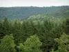
The Northern Vosges Regional Nature Park
| Municipality | Kirviller |
|---|---|
| Postcode | 57430 |
| Latitude | 48.9528390 (N 48° 57’ 10”) |
| Longitude | 6.9805860 (E 6° 58’ 50”) |
| Altitude | From 213m to 246m |
| Surface area | 2.54 km² |
| Population | 141 inhabitants |
| Density | 55 inhabitants/km² |
| Prefecture | Metz (84 km, 1:01) |
| Insee code | 57366 |
| Intercommunality | CA Sarreguemines Confluences |
| Department | Moselle |
| Territory | Lorraine |
| Region | Great East |
| Honskirch | 3 km (5 min) |
|---|---|
| Altwiller | 4.9 km (9 min) |
| Bissert | 5 km (9 min) |
| Vittersbourg | 5.4 km (9 min) |
| Hazembourg | 5.5 km (12 min) |
| Harskirchen | 6.1 km (9 min) |
| Sarralbe | 7.1 km (12 min) |
| Le Val-de-Guéblange | 7.5 km (10 min) |
| Keskastel | 8 km (12 min) |
| Vibersviller | 8.4 km (14 min) |
| Sarre-Union | 9.8 km (15 min) |
| Insming | 10 km (16 min) |
| Sarrewerden | 10 km (15 min) |
| Willerwald | 10.3 km (15 min) |
| Last name | Activity type | Rate | City |
|---|---|---|---|
 | Sports sensations | 25 € to 80 € | Niederbronn-les-Bains (49 km) |
| Last name | Outing type | Difficulty | Duration | Departure municipality |
|---|---|---|---|---|
 | Cycling itinerary | Easy | 4:00 | Lorentzen (14.3 km) |
| Hike | Easy | 2:00 | Diemeringen (15.1 km) |
| Cycling itinerary | Easy | 4:30 | Frauenberg (23 km) |
 | Hike | Easy | 35 min | Sarrebourg (25 km) |
 | Hike | Intermediate | 3:40 | La Petite-Pierre (27 km) |