


Favourite
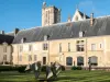
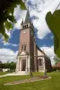
Troyes
| Municipality | Javernant |
|---|---|
| Postcode | 10320 |
| Latitude | 48.1606790 (N 48° 9’ 38”) |
| Longitude | 4.0021140 (E 4° 0’ 8”) |
| Surface area | 5.62 km² |
| Population | 157 inhabitants |
| Density | 27 inhabitants/km² |
| Prefecture | Troyes (19.8 km, 24 min) |
| Insee code | 10177 |
| Intercommunality | CA Troyes Champagne Métropole |
| Department | Aube |
| Territory | Champagne-Ardenne |
| Region | Great East |
| Crésantignes | 3 km (5 min) |
|---|---|
| Villery | 3.3 km (5 min) |
| Fays-la-Chapelle | 4.2 km (8 min) |
| Jeugny | 4.9 km (8 min) |
| Sommeval | 5 km (8 min) |
| Lirey | 5.4 km (10 min) |
| Machy | 5.6 km (9 min) |
| Saint-Jean-de-Bonneval | 5.8 km (11 min) |
| Bouilly | 6.2 km (9 min) |
| Chamoy | 7.1 km (7 min) |
| Souligny | 7.3 km (10 min) |
| Longeville-sur-Mogne | 7.5 km (12 min) |
| Assenay | 7.6 km (13 min) |
| Last name | Activity type | Rate | City |
|---|---|---|---|
 | Entertainment | 30 € to 40 € | Ville-sur-Arce (34 km) |
| Last name | Outing type | Difficulty | Duration | Departure municipality |
|---|---|---|---|---|
 | Hike | Easy | 4:45 | Sommeval (2.5 km) |
 | All-terrain bike itinerary | Easy | 3:30 | Bouilly (3.5 km) |
 | Hike | Easy | 4:45 | Eaux-Puiseaux (9.3 km) |
 | Hike | Easy | 3:20 | Bercenay-en-Othe (9.8 km) |
 | Hike | Easy | 1:45 | Ervy-le-Châtel (14.9 km) |