
Favourite
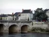
Richelieu
| Municipality | Jaulnay |
|---|---|
| Postcode | 37120 |
| Latitude | 46.9481600 (N 46° 56’ 53”) |
| Longitude | 0.4142940 (E 0° 24’ 51”) |
| Altitude | From 65m to 134m |
| Surface area | 14.76 km² |
| Population | 254 inhabitants |
| Density | 17 inhabitants/km² |
| Prefecture | Tours (85 km, 56 min) |
| Insee code | 37121 |
| Intercommunality | CC Touraine Val de Vienne |
| Department | Indre-et-Loire |
| Territories | Loire Valley, Touraine |
| Region | Centre-Loire Valley |
| Razines | 5.2 km (5 min) |
|---|---|
| Saint-Christophe | 5.3 km (8 min) |
| Saint-Gervais-les-Trois-Clochers | 5.7 km (9 min) |
| Mondion | 5.8 km (9 min) |
| Faye-la-Vineuse | 7 km (8 min) |
| Leigné-sur-Usseau | 7 km (7 min) |
| Sérigny | 7.6 km (11 min) |
| Marigny-Marmande | 7.7 km (10 min) |
| Braye-sous-Faye | 7.9 km (7 min) |
| Braslou | 8.6 km (10 min) |
| Vellèches | 9.6 km (11 min) |
| Sossais | 11.2 km (14 min) |
| Richelieu | 11.3 km (10 min) |
| Orches | 11.6 km (18 min) |
| Last name | Activity type | Rate | City |
|---|---|---|---|
 | Entertainment | 5 € to 7 € | Turquant (42 km) |
| Last name | Outing type | Difficulty | Duration | Departure municipality |
|---|---|---|---|---|
 | Hike | Easy | 1:30 | Nouâtre (15.4 km) |
 | Hike | Easy | 3:00 | Mouterre-Silly (28 km) |
 | Village visit | Easy | 3:00 | Saché (35 km) |
 | Hike | Easy | 3:00 | Saché (35 km) |
 | Hike | Easy | 2:00 | Ternay (36 km) |