

Favourite
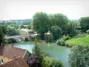
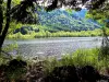
The Ognon Valley


| Municipality | Georfans |
|---|---|
| Postcode | 70110 |
| Latitude | 47.5366240 (N 47° 32’ 12”) |
| Longitude | 6.5119040 (E 6° 30’ 43”) |
| Altitude | From 282m to 375m |
| Surface area | 2.99 km² |
| Population | 45 inhabitants |
| Density | 15 inhabitants/km² |
| Prefecture | Vesoul (33 km, 36 min) |
| Insee code | 70264 |
| Intercommunality | CC du Pays de Villersexel |
| Department | Haute-Saône |
| Territory | Franche-Comté |
| Region | Burgundy-Franche-Comté |
| Saint-Ferjeux | 1 km (3 min) |
|---|---|
| Mélecey | 2.6 km (4 min) |
| Vellechevreux-et-Courbenans | 3.8 km (5 min) |
| Villargent | 3.9 km (5 min) |
| Beveuge | 4 km (10 min) |
| Fallon | 4.2 km (7 min) |
| Senargent-Mignafans | 4.9 km (8 min) |
| Courchaton | 4.9 km (7 min) |
| Grammont | 4.9 km (7 min) |
| Secenans | 6 km (6 min) |
| Villers-la-Ville | 6.2 km (7 min) |
| Bournois | 6.6 km (10 min) |
| Abbenans | 6.9 km (10 min) |
| Crevans-et-la-Chapelle-lès-Granges | 6.9 km (7 min) |
| Last name | Activity type | Rate | City |
|---|---|---|---|
 | Culture and education | 11 € | Le Thillot (42 km) |
 | Entertainment | 84 € to 110 € | Besançon (50 km) |
| Last name | Outing type | Difficulty | Duration | Departure municipality |
|---|---|---|---|---|
 | Hike | Easy | 1:00 | Pays-de-Clerval (16 km) |
 | Hike | Intermediate | 35 min | Grand-Charmont (23 km) |
 | Hike | Easy | 1:05 | Ferrières-lès-Scey (39 km) |
 | Hike | Easy | 1:00 | Sewen (42 km) |
 | Hike | Athletic | 5:05 | Fretigney-et-Velloreille (43 km) |