
Favourite
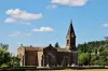
Romans-sur-Isère


| Municipality | Génissieux |
|---|---|
| Postcode | 26750 |
| Latitude | 45.0824910 (N 45° 4’ 57”) |
| Longitude | 5.0873020 (E 5° 5’ 14”) |
| Altitude | From 177m to 303m |
| Surface area | 8.93 km² |
| Population | 2468 inhabitants |
| Density | 276 inhabitants/km² |
| Prefecture | Valence (29 km, 32 min) |
| Insee code | 26139 |
| Intercommunality | CA Valence Romans Agglo |
| Department | Drôme |
| Territories | Dauphiné, Drôme-Ardèche |
| Region | Auvergne-Rhône-Alps |
| Mours-Saint-Eusèbe | 3.2 km (6 min) |
|---|---|
| Triors | 3.6 km (6 min) |
| Châtillon-Saint-Jean | 3.9 km (6 min) |
| Peyrins | 4 km (6 min) |
| Saint-Paul-lès-Romans | 4.7 km (9 min) |
| Geyssans | 4.8 km (7 min) |
| Romans-sur-Isère | 6.3 km (10 min) |
| Bourg-de-Péage | 6.4 km (10 min) |
| Parnans | 6.7 km (11 min) |
| Saint-Michel-sur-Savasse | 8.1 km (10 min) |
| Eymeux | 9.6 km (13 min) |
| Montmiral | 10.4 km (13 min) |
| Saint-Lattier | 10.5 km (16 min) |
| Margès | 10.7 km (12 min) |

| Last name | Activity type | Rate | City |
|---|---|---|---|
 | Culture and education | 17 € | Pont-en-Royans (20 km) |
 | Local flavours | Free | Eclassan (27 km) |
 | Sports sensations | 45 € to 75 € | Autrans-Méaudre en Vercors (37 km) |
 | Entertainment | 130 € to 240 € | Saint-Jean-de-Bournay (47 km) |
 | Nature and the great outdoors | 30 € to 305 € | Flachères (47 km) |
| Last name | Outing type | Difficulty | Duration | Departure municipality |
|---|---|---|---|---|
 | Hike | Intermediate | 3:00 | Saint-Donat-sur-l'Herbasse (9.3 km) |
 | Hike | Intermediate | 9:00 | Saint-Nazaire-en-Royans (12.7 km) |
 | Hike | Easy | 1:30 | Tournon-sur-Rhône (20 km) |
 | Hike | Easy | 3:00 | Vassieux-en-Vercors (28 km) |
 | Cycling itinerary | Intermediate | 2:15 | Beaurepaire (29 km) |