Favourite
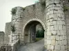
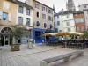
Marvejols
| Municipality | Gabrias |
|---|---|
| Postcode | 48100 |
| Latitude | 44.5447950 (N 44° 32’ 41”) |
| Longitude | 3.3729980 (E 3° 22’ 23”) |
| Altitude | From 717m to 1200m |
| Surface area | 20.65 km² |
| Population | 166 inhabitants |
| Density | 8 inhabitants/km² |
| Prefecture | Mende (15.2 km, 21 min) |
| Insee code | 48068 |
| Intercommunality | CC du Gévaudan |
| Department | Lozère |
| Territories | Languedoc-Roussillon, Massif Central |
| Region | Occitanie |
| Montrodat | 6.2 km (11 min) |
|---|---|
| Grèzes | 6.9 km (17 min) |
| Barjac | 8.1 km (13 min) |
| Marvejols | 8.7 km (14 min) |
| Cultures | 11.1 km (18 min) |
| Palhers | 12.6 km (19 min) |
| Antrenas | 12.8 km (19 min) |
| Esclanèdes | 13.3 km (18 min) |
| Saint-Léger-de-Peyre | 14.3 km (21 min) |
| Bourgs sur Colagne | 14.4 km (20 min) |
| Balsièges | 14.8 km (19 min) |
| Saint-Bonnet-de-Chirac | 15.3 km (26 min) |
| Mende | 15.8 km (22 min) |
| Chanac | 16 km (22 min) |
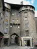
| Monuments |
|---|
| Last name | Activity type | Rate | City |
|---|---|---|---|
 | Sports sensations | 35 € | La Canourgue (17.8 km) |
 | Arts and Crafts | 55 € to 140 € | Saint-Martin-de-Lenne (35 km) |
 | Arts and Crafts | Free | Laguiole (44 km) |
| Last name | Outing type | Difficulty | Duration | Departure municipality |
|---|---|---|---|---|
 | Hike | Intermediate | 4:00 | Hures-la-Parade (33 km) |
 | All-terrain bike itinerary | Easy | 2:40 | Sévérac d'Aveyron (35 km) |
 | Hike | Easy | 2:00 | Pont de Montvert - Sud Mont Lozère (36 km) |
 | Hike | Intermediate | 4:00 | Pont de Montvert - Sud Mont Lozère (36 km) |
 | Hike | Easy | 45 min | Langogne (43 km) |