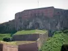
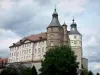
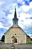
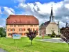
Liven up your holidays!

Froidefontaine

Tourism, holidays & weekends guide in the Territoire de Belfort

Froidefontaine - Tourism, holidays & weekends guide in the Territoire de Belfort
7.4
3

Geographical information

MunicipalityFroidefontaine
Postcode90140
Latitude47.5644970 (N 47° 33’ 52”)
Longitude6.9494500 (E 6° 56’ 58”)
AltitudeFrom 330m to 388m
Surface area4.55 km²
Population480 inhabitants
Density105 inhabitants/km²
PrefectureBelfort (17.7 km, 18 min)
Insee code90051
IntercommunalityCC du Sud Territoire
DepartmentTerritoire de Belfort
TerritoryFranche-Comté
RegionBurgundy-Franche-Comté

Nearest cities & towns

Charmois1.5 km (2 min)
Brebotte3 km (5 min)
Morvillars3.2 km (6 min)
Recouvrance3.2 km (5 min)
Bourogne3.9 km (7 min)
Grosne4.6 km (6 min)
Meroux-Moval4.9 km (7 min)
Autrechêne5.3 km (7 min)
Méziré5.6 km (10 min)
Grandvillars5.8 km (10 min)
Vellescot6.1 km (8 min)
Fesches-le-Châtel6.5 km (11 min)
Bretagne6.7 km (9 min)
Novillard7.3 km (11 min)

Photos

The church and the cure (© J.E)
See photo
Turning bridge, on the Rhone-Rhine canal (© J.E)
See photo
River la Bourbeuse to Froidefontaine (© J.E)
See photo
The cure (© J.E)
The cure (© J.E)
See photo
The town hall (© J.E)
See photo
Holy water font of the church Saints Peter and Paul (© J.E)
See photo
Door lintel key, dated (© J.E)
See photo
Door lintel key, dated (© J.E)
See photo
Cross of the church square (© J.E)
See photo
Decoration of the choir of the church, in braided rings (© J.E)
See photo
Façade of the church (© J.E)
See photo
Baptismal cistern in the church (© J.E)
See photo
Information on the church (© J.E)
See photo
Information on the church (© J.E)
See photo
Old inscription with coat of arms, in the church (© J.E)
See photo
Medallion above the door of the cure (© J.E)
See photo
Nave of the church (© J.E)
See photo
Nave of the church, view of the choir (© J.E)
See photo
Sculpture of the outer headband of the apse of the church (© J.E)
See photo
Sculpture of the outer headband of the apse of the church (© J.E)
See photo
Sculpture of the outer headband of the apse of the church (© J.E)
See photo
Statue of Saint Michael the Archangel, in the church (© J.E)
See photo
Statue in the church (© J.E)
See photo
Statue in the church (© J.E)
See photo
Statues in the church (© J.E)
See photo
Canal du Rhône au Rhin, seen from the rotating bridge (© J.E)
See photo

Weather

Thursday 18 april
Min. 2°C - Max. 7°C
Day
Night
Friday 19 april
Min. 1°C - Max. 8°C
Day
Night
Saturday 20 april
Min. 2°C - Max. 8°C
Day
Night

Visits, leisure and activities nearby

Leisure activities

Last nameActivity typeRateCity
Visit a copper mine
Culture and education11 € Le Thillot (37 km)
Interactive tour of a leather studio
Arts and Crafts12 € Basse-sur-le-Rupt (50 km)

Outings

Last nameOuting typeDifficultyDurationDeparture municipality
Walk to Fort Lachaux- Grand-Charmont, Sochaux, Montbéliard
HikeIntermediate35 minGrand-Charmont (10.7 km)
Tour of the historic centre
Village visitEasy1:00Masevaux-Niederbruck (23 km)
Rangen massif
HikeIntermediate1:00Burnhaupt-le-Haut (24 km)
Sattelboden Chalet
HikeIntermediate3:00Masevaux-Niederbruck (24 km)
Lachtelweiher Lake
HikeIntermediate2:30Kirchberg (26 km)

Restaurants

Bed & breakfasts

Vacation rentals

Campsites

Hotels

Your holidays
A hotel
A vacation rental
A bed & breakfast
A campsite
A leisure activity
A restaurant
A rental car
A plane ticket
By continuing to browse our site, you are agreeing to the use of cookies to improve your experience and make targeted offers.
Find out more and make settings
Your account