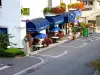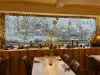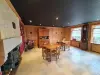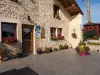

Favourite
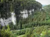
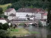
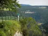
The Doubs gorges


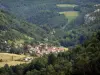
| Municipality | Frambouhans |
|---|---|
| Postcode | 25140 |
| Latitude | 47.2169730 (N 47° 13’ 1”) |
| Longitude | 6.7662500 (E 6° 45’ 59”) |
| Altitude | From 820m to 960m |
| Surface area | 10.10 km² |
| Population | 914 inhabitants |
| Density | 90 inhabitants/km² |
| Prefecture | Besançon (69 km, 1:04) |
| Insee code | 25256 |
| Intercommunality | CC du Pays de Maîche |
| Department | Doubs |
| Territories | Franche-Comté, Jura mountains |
| Region | Burgundy-Franche-Comté |
| Les Écorces | 3.2 km (5 min) |
|---|---|
| Les Fontenelles | 3.2 km (4 min) |
| Saint-Julien-lès-Russey | 4.8 km (8 min) |
| Charquemont | 5 km (7 min) |
| Bonnétage | 5.4 km (6 min) |
| Maîche | 5.4 km (6 min) |
| Mont-de-Vougney | 6.6 km (18 min) |
| Le Russey | 7.7 km (9 min) |
| Mancenans-Lizerne | 8 km (12 min) |
| Cernay-l'Église | 8.6 km (13 min) |
| Les Bréseux | 8.8 km (11 min) |
| Le Luhier | 10.5 km (9 min) |
| Thiébouhans | 10.8 km (11 min) |
| Fournet-Blancheroche | 10.9 km (13 min) |


| Last name | Outing type | Difficulty | Duration | Departure municipality |
|---|---|---|---|---|
 | Hike | Easy | 1:00 | Pays-de-Clerval (28 km) |
 | Hike | Intermediate | 35 min | Grand-Charmont (34 km) |
 | Hike | Intermediate | 35 min | Hauterive-la-Fresse (36 km) |
 | Hike | Easy | 1:05 | La Rivière-Drugeon (57 km) |
 | Hike | Easy | 6:00 | Devecey (58 km) |