- Presentation and situation of the town:
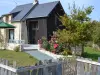
- Fégréac is located in the Loire-Atlantique department (Pays de la Loire region) and more precisely in the canton of Pontchâteau and 8 km from Redon. The total area of the municipality of 44.18 km², the population density is therefore about 52 inhabitants / km². The town now has nearly 2,500 inhabitants. The town is made up of a town and 32 villages. In the village you can find all the shops there. A mini-market, a baker, a hairdresser, a café, a bar, a butcher, a catering restaurant, a pharmacy, a miscellaneous store. In addition to the attractiveness of its traders, it welcomes every Friday from 9h to 12h a local farmers market. Many companies or artisans are also present in the town to the delight of the Fégréacais.
- Fégréac has two schools La Madeleine (public school) and St Charles (private). In addition to the pharmacy, a doctor, 3 nurses, an osteopath, a physiotherapist, a psycho practitioner, an EHPAD with 92 beds is installed in the town. A square hosting a brand new ballroom located right next to a state-of-the-art media library, where you can consult many books, access to a digital room, and discovery shows for children and adults alike. The commune of Fégréac is recognized for its important associative fabric thus allowing everyone to practice an activity, whether it is cultural, sporting, leisure... A sports hall, a football field, are at their disposal.
- Fégréac is a member of Redon Agglomeration. Intercommunality is becoming more and more important for day-to-day management, taking more and more initiatives in favor of citizens; it has more and more powers, delegated by the municipalities that are members of the grouping. Through this community, the municipality of Fégréac is also a member of the Pays de Redon-Bretagne Sud organization, grouping together 43 municipalities of Ille et Vilaine, Loire-Atlantique and Morbihan.
- Fégréac has a campsite on the banks of the Vilaine as well as many lodgings, in great demand during the summer months and located along the Nantes-Brest canal.
- The origin of the name of Fégréac:
- 2 main theses clash with respect to the origin of the name of the town:
- First of all, you have to know the suffix "AC" comes from Latin "ACUM" and Celtic "ACOS" both meaning "DOMAIN OF". Knowing this, we can first think that the name of the town would come from the Roman conquest: when Gaul was fully colonized, the Romans divided the Empire between them during the period of peace that followed, each soldier being assigned a part. of the territory to be administered. This is how Avittius received a domain to which he gave his name (Avessac currently), like his comrade Sévérus (Sévérac). The area located between the two, corresponding to the current territory of Fégréac, would have belonged to a possible Roman named Feguerus, which would be confirmed by the evolution of the name of the town, called Féguérac during the Middle Ages.
- The other proposition concerning the origin of the name would be much simpler: Fégréac would originate from the domain of Féguié, a deformation of the Fig tree: Fégréac would therefore be the domain of the Fig tree.
- History of the town:
- The foundation of the village dates back to antiquity, there are also several traces of the Gallo-Roman era, the Roman road being the best known and the most visible.
- While plowing, farmers sometimes stumble upon period elements. The inhabitants of Rieux know that their commune was called DURETIE, but this great agglomeration probably had the particularity of being "astride" on the Vilaine, at the place where the Roman road from Nantes to Carhaix and Brest was crossed. Thus, the Gallo-Romans left visible traces of this agglomeration, on the side Fégréac, in particular a granite architrave (unique piece in the department), coins, remains of several living rooms ("villa" of La Rochelle), pottery shards and fragments of molded terracotta figurines, including "the" famous Venus of Fégréac.
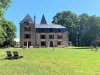
- The parish of Fégréac crosses the whole of the Middle Ages as part of the domain of the family of the Sires of Rieux, a period of which some traces still remain today (for example, the old granite porch in the village of Penhoët, where the famous 15th century cross, located behind the church, has been listed as a Historic Monument since 1951).
- During the Revolution, then under Napoleon, the town had around 1,800 inhabitants, slightly less than its current population. It developed in part thanks to the canalization of the Isac to link Nantes and Brest, Napoleon I seeing it as a means of supplying the port city without running the risk of sailing in the Atlantic Ocean, then controlled by the powerful English fleet..
- It is moreover this canal which will serve as a front line between the Allied troops and the German soldiers taking refuge in the "pocket of Saint-Nazaire" between mid-August 1944 and the capitulation of May 8, 1945.