Favourite
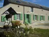
Bourges
| Municipality | Farges-en-Septaine |
|---|---|
| Postcode | 18800 |
| Latitude | 47.0732610 (N 47° 4’ 24”) |
| Longitude | 2.6504990 (E 2° 39’ 2”) |
| Altitude | From 144m to 181m |
| Surface area | 24.48 km² |
| Population | 1019 inhabitants |
| Density | 41 inhabitants/km² |
| Prefecture | Bourges (23 km, 29 min) |
| Insee code | 18092 |
| Intercommunality | CC La Septaine |
| Department | Cher |
| Territory | Berry |
| Region | Centre-Loire Valley |
| Villabon | 3.4 km (5 min) |
|---|---|
| Avord | 5.1 km (5 min) |
| Brécy | 6.4 km (8 min) |
| Nohant-en-Goût | 6.9 km (8 min) |
| Baugy | 7.8 km (9 min) |
| Savigny-en-Septaine | 8.5 km (11 min) |
| Jussy-Champagne | 10.8 km (12 min) |
| Crosses | 11.8 km (14 min) |
| Moulins-sur-Yèvre | 12.9 km (15 min) |
| Sainte-Solange | 13.4 km (16 min) |
| Rians | 13.6 km (14 min) |
| Osmoy | 13.7 km (15 min) |
| Villequiers | 14 km (16 min) |
| Saint-Germain-du-Puy | 14 km (16 min) |
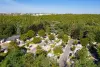
| Natural sites |
|---|
| Last name | Activity type | Rate | City |
|---|---|---|---|
 | Culture and education | Free | Germigny-l'Exempt (26 km) |
 | Well-being | 720 € to 3624 € | Nevers (39 km) |
| Last name | Outing type | Difficulty | Duration | Departure municipality |
|---|---|---|---|---|
 | Cycling itinerary | Easy | 2:00 | Saint-Satur (33 km) |
| Hike | Easy | 2:00 | Quincy (38 km) |
 | Hike | Intermediate | 6:00 | Champlemy (58 km) |