Favourite
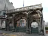
The Mining History Centre of Lewarde
| Municipality | Erre |
|---|---|
| Postcode | 59171 |
| Latitude | 50.3604780 (N 50° 21’ 38”) |
| Longitude | 3.3164470 (E 3° 18’ 59”) |
| Altitude | From 16m to 49m |
| Surface area | 5.88 km² |
| Population | 1589 inhabitants |
| Density | 270 inhabitants/km² |
| Prefecture | Lille (59 km, 45 min) |
| Insee code | 59203 |
| Intercommunality | CC Cœur d'Ostrevent |
| Department | Nord |
| Territory | Flandre-Artois |
| Region | Hauts-de-France |
| Fenain | 1.8 km (3 min) |
|---|---|
| Hornaing | 2 km (5 min) |
| Somain | 2.7 km (5 min) |
| Abscon | 3.5 km (5 min) |
| Wandignies-Hamage | 4.5 km (8 min) |
| Hélesmes | 4.8 km (8 min) |
| Bruille-lez-Marchiennes | 5.9 km (12 min) |
| Escaudain | 6.3 km (7 min) |
| Wallers | 6.4 km (9 min) |
| Lourches | 7.4 km (9 min) |
| Mastaing | 7.4 km (12 min) |
| Marchiennes | 7.5 km (12 min) |
| Roeulx | 7.9 km (12 min) |
| Écaillon | 8.2 km (15 min) |
| Last name | Activity type | Rate | City |
|---|---|---|---|
 | Entertainment | 29 € | Lille (35 km) |
 | Entertainment | 24 € | Lille (35 km) |
 | Culture and education | 9 € | Croix (36 km) |
| Last name | Outing type | Difficulty | Duration | Departure municipality |
|---|---|---|---|---|
 | Hike | Easy | 20 min | Cambrai (21 km) |
 | Hike | Easy | 3:05 | Beaumont-Hamel (55 km) |