Liven up your holidays!

Dompierre-sur-Charente

Tourism, holidays & weekends guide in the Charente-Maritime

Geographical information

MunicipalityDompierre-sur-Charente
Postcode17610
Latitude45.7000018 (N 45° 42’ 0”)
Longitude-0.4833357 (W 0° 29’ 0”)
AltitudeFrom 2m to 70m
Surface area8.29 km²
Population483 inhabitants
Density58 inhabitants/km²
PrefectureLa Rochelle (87 km, 1:03)
Insee code17141
IntercommunalityCA de Saintes
DepartmentCharente-Maritime
TerritoryCharentes
RegionNew-Aquitaine

Nearest cities & towns

Chérac5.4 km (9 min)
Brives-sur-Charente5.5 km (7 min)
Saint-Sauvant5.5 km (9 min)
Chaniers6.2 km (7 min)
Saint-Laurent-de-Cognac7.7 km (10 min)
Saint-Césaire8 km (14 min)
Rouffiac8.1 km (13 min)
Saint-Sever-de-Saintonge9.2 km (13 min)
Louzac-Saint-André9.2 km (12 min)
Salignac-sur-Charente9.3 km (15 min)
Montils10.2 km (14 min)
Saint-Bris-des-Bois10.3 km (14 min)
La Chapelle-des-Pots11.1 km (16 min)
Courcoury11.2 km (16 min)

Things to see and do

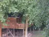
There are Dompierre-sur-Charente the last chain bucket of France. Open from June 15 to September 15, he can rally Rouffiac Dompierre. Created in the years 1840-1850, it has always been powered by energy physics smuggler. This leaves a heritage to discover. If you drive here, take a voyage in time and make a leap into the past through the "Cha little goes a long way."

Weather

Tuesday 16 april
Min. 8°C - Max. 15°C
Day
Night
Wednesday 17 april
Min. 5°C - Max. 14°C
Day
Night
Thursday 18 april
Min. 4°C - Max. 14°C
Day
Night

Visits, leisure and activities nearby

Leisure activities

Last nameActivity typeRateCity
Treetop rope course and giant ziplines
Sports sensations10 € to 20 € Saint-Bris-des-Bois (7.9 km)
Tour and tasting at the Domaine Montansier
Local flavoursFreeGraves-Saint-Amant (31 km)
See the Arvert peninsula from the sky
Entertainment40 € Saint-Sulpice-de-Royan (41 km)
Parachute jump above the Marennes-Oléron Basin
Sports sensations275 € Marennes-Hiers-Brouage (44 km)
Le Ferron animal park
Nature and the great outdoors5 € to 8 € Condéon (45 km)

Outings

Last nameOuting typeDifficultyDurationDeparture municipality
River side & nature side
HikeEasy1:05Saintes (12.4 km)
Saintes - Saintonge, the Gallo-Roman heritage
HikeEasy4:05Saintes (13.5 km)
Chemin des Mottes
Village visitEasy1:00Le Gua (36 km)
The Bouclettes
Cycling itineraryEasy1:30Saint-Fort-sur-Gironde (37 km)
Circuit of Puyrolland
HikeEasy3:45Puyrolland (39 km)

Restaurants

Bed & breakfasts

Vacation rentals

Campsites

Hotels

Your holidays
A hotel
A vacation rental
A bed & breakfast
A campsite
A leisure activity
A restaurant
A rental car
A plane ticket
By continuing to browse our site, you are agreeing to the use of cookies to improve your experience and make targeted offers.
Find out more and make settings
Your account