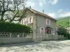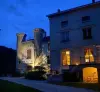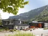


Favourite
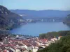
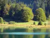
Nantua Lake


| Municipality | Condamine |
|---|---|
| Postcode | 01430 |
| Latitude | 46.1083860 (N 46° 6’ 30”) |
| Longitude | 5.5507950 (E 5° 33’ 3”) |
| Altitude | From 518m to 808m |
| Surface area | 4.64 km² |
| Population | 473 inhabitants |
| Density | 101 inhabitants/km² |
| Prefecture | Bourg-en-Bresse (45 km, 35 min) |
| Insee code | 01112 |
| Intercommunality | CA Haut - Bugey Agglomération |
| Department | Ain |
| Territories | Alps, Jura mountains |
| Region | Auvergne-Rhône-Alps |
| Maillat | 3 km (6 min) |
|---|---|
| Vieu-d'Izenave | 3.7 km (4 min) |
| Saint-Martin-du-Frêne | 3.8 km (4 min) |
| Chevillard | 4.2 km (6 min) |
| Outriaz | 5.1 km (7 min) |
| Port | 6.9 km (7 min) |
| Lantenay | 7.1 km (10 min) |
| Brion | 8.5 km (10 min) |
| Izenave | 9 km (9 min) |
| Ceignes | 9 km (9 min) |
| Nantua | 10.1 km (15 min) |
| Montréal-la-Cluse | 10.2 km (13 min) |
| Corlier | 10.7 km (11 min) |
| Brénod | 11.6 km (14 min) |


| Last name | Activity type | Rate | City |
|---|---|---|---|
 | Culture and education | 36 € | Pérouges (37 km) |
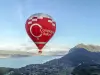
 | Entertainment | 17 € | Pérouges (37 km) |
 | Sports sensations | 40 € to 65 € | Saint-Claude (39 km) |
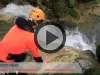 | Sports sensations | 45 € | Saint-Claude (39 km) |
 | Sports sensations | 280 € | La Balme-de-Sillingy (41 km) |
| Last name | Outing type | Difficulty | Duration | Departure municipality |
|---|---|---|---|---|
 | Hike | Intermediate | 3:30 | Saint-Martin-du-Frêne (3.3 km) |
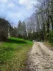 | Hike | Intermediate | 5:30 | Nantua (6.1 km) |
 | All-terrain bike itinerary | Easy | 1:30 | Nantua (6.3 km) |
 | Hike | Athletic | 6:35 | Nantua (6.7 km) |
 | All-terrain bike itinerary | Intermediate | 1:50 | Brénod (6.8 km) |